Winter Weather Is Moving West: How The Polar Vortex Is Rewriting America’s Cold Map
How did your country report this? Share your view in the comments.
Diverging Reports Breakdown
Winter Weather Is Moving West: How The Polar Vortex Is Rewriting America’s Cold Map
Major study of 42 years of data shows severe winter storms have shifted northwest, away from the traditional snow belt. This shift is linked to changes in the polar vortex, which now wobbles westward more often, targeting the Pacific Northwest and northern Rockies. La Niña cycles may be boosting the westward pattern — 64% of recent winters showed LaNiña-like conditions.Communities from Montana to Washington may need new infrastructure plans to cope with more frequent extreme cold, snow, and power grid strain. The mechanism involves atmospheric waves that bounce between the upper atmosphere and ground level, amplifying weather patterns and making them more extreme. It’s essentially nature’s way of turning up the volume on winter weather. The study found that “64.3% of the January to February 2008 to 2021 Oceanic Niño Index values” were negative during this period, indicating La Niño-like weather patterns were more common in that time period. The research was published in Science Advances, a journal of the American Meteorological Society.
In A Nutshell A major study of 42 years of data shows severe winter storms have shifted northwest, away from the traditional snow belt.
This shift is linked to changes in the polar vortex, which now wobbles westward more often, targeting the Pacific Northwest and northern Rockies.
La Niña cycles may be boosting the westward pattern — 64% of recent winters showed La Niña-like conditions.
Communities from Montana to Washington may need new infrastructure plans to cope with more frequent extreme cold, snow, and power grid strain.
LOWELL, Mass. — Americans expecting the worst winter weather to slam the East Coast might need to look northwest instead. A major study spanning four decades reveals that severe winter storms are shifting away from traditional snow belt regions toward the Pacific Northwest and northern Rockies, potentially changing where Americans should brace for brutal cold and heavy snow.
The culprit? Changes in the polar vortex, that massive, spinning ring of cold air that sits high above the Arctic. When this atmospheric giant wobbles in different directions, it determines which parts of America get pummeled by winter’s worst conditions.
Scientists analyzed 42 years of weather data and discovered two distinct polar vortex patterns that each deliver misery to different regions. Since 2015, one pattern has become dramatically more common, explaining why places like Montana and Washington are seeing more severe winter weather while traditional East Coast snow zones experience somewhat less.
Two Patterns, Two Very Different Winters
Researchers identified five polar vortex behaviors, but two stand out for their ability to create havoc across America. According to the study, published in Science Advances, the first pattern “features an upper-level vortex displaced toward western Canada and linked to northwestern U.S. severe winter weather.” The second “features a weakened upper-level vortex displaced toward the North Atlantic and linked to central-eastern U.S. severe winter weather.”
When the polar vortex tips westward, states like Montana, Idaho, and Washington bear the brunt of winter fury. When it shifts eastward, areas from the Great Lakes down to the Southeast get hammered instead.
The mechanism involves atmospheric waves that bounce between the upper atmosphere and ground level, amplifying weather patterns and making them more extreme. Scientists call this “stratospheric wave reflection,” which is essentially nature’s way of turning up the volume on winter weather.
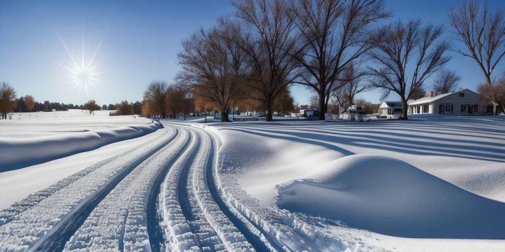
Research shows that extreme winter weather is shifting northwestward, meaning areas in the Pacific Northwest that typically experienced milder winters is likely to see more severe wintry conditions in the future. (© ugljesaras – stock.adobe.com)
The Great Winter Weather Migration
Since 2015, severe winter conditions have been migrating northwestward across the country. The research shows “a northwestward shift in severe winter weather across the US is concurrent with an increase in the frequency of the westward-focused variation relative to the eastward-focused variation.”
Communities in the Pacific Northwest and northern Rockies that historically dealt with milder winters now face more frequent extreme conditions. Meanwhile, areas that typically prepared for brutal winters, from New England down through the Mid-Atlantic, are seeing their severe weather expectations shift.
The study notes that recent U.S. cold extremes occurred “in the winters of 2009/2010, 2013/2014, 2014/2015, 2020/2021, and 2024/2025,” demonstrating these new patterns in action across different regions.
La Niña’s Hidden Influence
The research uncovered a connection between these shifting patterns and La Niña cycles — periods when Pacific Ocean temperatures drop below normal. The western-focused pattern that brings severe weather to the northwestern U.S. occurs more often during La Niña conditions.
Since 2000, La Niña events have become more frequent, potentially explaining why northwestern states are experiencing more severe winter weather. The study found that “64.3% of the January to February 2008 to 2021 Oceanic Niño Index values” were negative during this period, indicating La Niña-like conditions.
Pacific Ocean temperature changes create ripple effects throughout global weather patterns, influencing how the polar vortex behaves and where it sends its worst weather. Rather than just measuring temperature drops, scientists examined comprehensive winter severity using an index that combines temperature, snowfall, and snow depth. This approach captures the full impact of winter weather events that shut down cities, strain power grids, and create dangerous conditions for millions.
Composite MERRA-2 2-m temperature anomalies (K) for (A) all days from 2008 to 2014 and (B) 2015 to 2021 and (C) the difference (latter period minus earlier period). J/F, January/February. (D) to (F) are similar to (A) to (C) except for P2 and P3 events only. P2 and P3 events are defined as three or more consecutive days within each cluster. (Credit: Agel et al / Science Advances)
The northwestern pattern particularly excels at producing severe snowfall, while the central-eastern pattern delivers both extreme cold and heavy snow. These differences matter enormously for emergency preparedness, infrastructure planning, and energy grid management.
Despite overall warming trends from climate change, the study notes that “episodes of extreme winter cold and snow continue to occur in many of these mid-latitude regions.” Winter weather events continue occurring with similar intensity — they’re just happening in different places.
Communities in the Pacific Northwest and northern Rockies may need to invest more heavily in winter weather infrastructure, while traditional snow belt regions should remain vigilant as the eastern pattern still occurs regularly. The polar vortex’s wandering behavior reshapes where winter hits hardest, demanding new approaches to preparation that match atmospheric realities. As these patterns continue evolving, Americans from Seattle to Syracuse need awareness of how shifting polar vortex behavior affects their winter weather expectations.
Disclaimer: This article summarizes findings from Cold-Air Outbreaks in the Continental US: Connections with Stratospheric Variations (Agel et al., Science Advances, 2025). The study describes statistical trends in weather patterns over four decades; it does not predict specific future storms. Readers should always consult local weather forecasts and official emergency guidance when preparing for winter weather.
Source: https://studyfinds.org/winter-weather-moving-west-how-the-polar-vortex-rewriting-americas-cold-map/