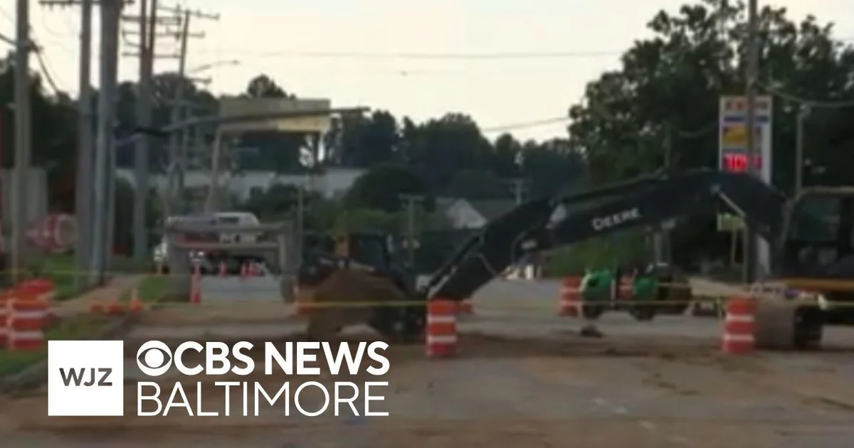
Baltimore County water main repairs could cause travel detours on Monday
How did your country report this? Share your view in the comments.
Diverging Reports Breakdown
Montgomery County Expects 4-6 Inches of Snowfall Late Tuesday, Feb. 11, into Wednesday Morning, Feb. 12
Heavy snow with accumulations between 4-6 inches is possible. Tuesday evening and Wednesday morning commutes are expected to be impacted. Cold temperatures will remain around freezing overnight and into Wednesday morning and snow is expected to turn to rain on Wednesday afternoon. MCDOT urges residents to stay off roadways once snowfall begins. US 29 Flash (Colesville Road/Old Columbia Pike) Bus Rapid Transit bus service may use 40-foot buses in place of Flash-branded articulated buses. Riders should check for information about service delays or detours online at RideOnBus.com. The department has approximately 165 in-house plows and a large number of loaders and other pieces of equipment for snow events. Heavier storms could require an additional 200 to 300 contractor trucks.
Montgomery County Department of Transportation (MCDOT) has begun pretreating County roads with salt brine, a mixture of salt and water, and will activate the Storm Operations Center (SOC) as of 10 a.m. on Tuesday. Crews will begin monitoring roadway conditions and responding as necessary. Cold temperatures will remain around freezing overnight and into Wednesday morning and snow is expected to turn to rain on Wednesday afternoon.
Roads, especially bridges and overpasses, will likely become slick and hazardous. MCDOT urges residents to stay off roadways once snowfall begins. Those who must travel should proceed with caution, leaving plenty of room between themselves and the motorist ahead of them and allow extra time to reach their destination.
MCDOT’s Ride On bus service will operate on a regular schedule on Tuesday, Feb. 11, with possible changes depending on snow accumulations later in the day and on Wednesday morning, Feb. 12. Snow-related detours and delays are likely. US 29 Flash (Colesville Road/Old Columbia Pike) Bus Rapid Transit bus service may use 40-foot buses in place of Flash-branded articulated buses. Riders should check for information about service delays or detours online at RideOnBus.com.
What to Expect
MCDOT is responsible for clearing 5,300 lane miles of County roads, including 1,608 emergency primary routes and 3,700 residential roads. The department has approximately 165 in-house plows and a large number of loaders and other pieces of equipment for snow events. Heavier storms could require an additional 200 to 300 contractor trucks. MCDOT also has contract tree crews available for ice and windstorms to address downed trees and assist PEPCO with outages.
Emergency primary routes are cleared first to ensure emergency vehicles can respond. Once the snow stops and emergency roads are clear, plows begin clearing residential streets. Throughout the storm, plows may begin plowing residential streets and then be called back to retreat to emergency primary roads. Roads marked with numbered routes are State Highway Roads and are maintained by the State.
It is important to note that plowing is intended to make streets passable, not to clear them to bare pavement.
Residents may see snowplows driving through neighborhoods with plows raised; this is due to snowpack from freezing temperatures. The plows are able to push off any fresh snow once it accumulates to about three inches and in areas that have been broken up by salt application. However, plows are not able to sufficiently push off solid ice, especially in the evening and late-night hours when temperatures are at their lowest points. In these cases, MCDOT snowplow crews raise the plow, apply salt, allow it to activate and then return to push the ice off. This process may require several attempts.
Where to Get Updates
Visit the County’s Snow Information Portal to find snow-related information, such as who is responsible for clearing a roadway, track plow progress in their area and report a missed street. Before making clearing requests, residents are asked to wait until snow operations are announced as complete at the top of the snow information portal page.
More rain, flooding expected in the Northeast as flash floods kill 2 in New Jersey
Two people were killed in flash flooding in New Jersey on July 14. Heavy rainfall swamped roads, knocked out power, and prompted water rescues. New Jersey Gov. Phil Murphy declared a state of emergency in response to the heavy rainfall. Parts of the Mid-Atlantic, including much of the state of Virginia, were under flood watches on July 15 as forecasters warned more thunderstorms and heavy downpours were in store. New York City’s Central Park recorded 2.07 inches of rain in one hour, the second-highest amount in an hour at that location in the city’s history, according to the mayor’s office. The storm came as the city was already reeling from a severe storm on July 3, when two men, ages 79 and 25, were killed by a tree that fell on their vehicle. “To lose four residents in such a short span of time is unimaginable. We mourn with the families,” Plainfield Mayor Adrian O. Mapp said in a news release. The National Weather Service said the rainfall and flash flood risks are expected to last through mid-week.
The storms caused flash flooding in the metropolitan areas from New York City to Washington, D.C., prompting road closures and a state of emergency declaration in New Jersey. Officials recorded 6 inches of rain in under two-and-a-half hours the evening of July 14, New Jersey Gov. Phil Murphy said in a news conference.
“Last night we got crushed,” Murphy told reporters on July 15.
Flood impacts are expected to continue on Tuesday, July 15, the National Weather Service in Mount Holly said.
The two victims were swept away in their vehicle in Plainfield, New Jersey, a suburb about 30 miles outside New York City, Murphy said. Their remains were recovered sometime overnight or early in the morning, he said.
Video posted to social media showed a New York City subway station inundated with fast-moving floodwaters as passengers watched from inside a train, lifting their feet to avoid the water rushing into the subway car. In McLean, Virginia, just outside Washington, videos showed cars stuck in floodwaters.
On July 15, parts of the Mid-Atlantic, including much of the state of Virginia, were under flood watches as forecasters warned more thunderstorms and heavy downpours were in store. The rainfall and flash flood risks to the Mid-Atlantic and Appalachian region are expected to last through mid-week, the National Weather Service said.
2 dead in New Jersey; Gov. declares state of emergency
The two people who died were swept away in their vehicle into Cedar Brook during the height of the storm, the city of Plainfield said in a news release. Emergency personnel responded quickly, but were unable to rescue the two victims, the city said.
The flooding in Plainfield came as the city was already reeling from a severe storm on July 3, when two men, ages 79 and 25, were killed by a tree that fell on their vehicle.
“To lose four residents in such a short span of time is unimaginable. We mourn with the families,” Plainfield Mayor Adrian O. Mapp said.
Murphy declared a state of emergency in response to the heavy rainfall and flash flooding on the evening of July 14.
“Please stay indoors and avoid unnecessary travel. Stay safe, New Jersey,” Murphy said.
Among the communities hardest hit were a cluster of New York suburbs, including North Plainfield, Piscataway, Watchung, Plainfield, Scotch Plains, Fanwood, and Westfield, reported MyCentralJersey.com, part of the USA TODAY Network. Multiple counties reported road closures. Thousands lost power the evening of July 14, with most service restored by the next morning.
Murphy said severe weather events were becoming more intense and common, and noted that the July 14 storm came in two waves.
“One wave knocked a lot of these communities a little bit off kilter and the second one came in for the kill,” he said.
New York City sees the second-highest rainfall in an hour
A rain gauge in New York City’s Central Park recorded 2.07 inches of rain in one hour, the second-highest amount in an hour at that location in the city’s history, according to the mayor’s office. The only higher amount recorded was during Hurricane Ida, when 3.15 inches were recorded on Sept. 1, 2021. The third-highest amount in an hour was 1.94 inches during Tropical Storm Henri in August 2021.
The hour of heavy rain was recorded between 6:51 p.m. and 7:51 p.m. on July 14, the mayor’s office said in a statement.
“While not currently a formal record, the reading reflects rainfall intensity consistent with two of New York City’s most extreme flood events,” the statement said.
Mayor Eric Adams commended first responders and city residents for their response to the storm: “Because people listened – because they stayed off flooded roads and helped protect one another – we avoided greater harm. This is how we meet the moment in a city facing rising climate risks.”
Homes flooded with 5 feet of water in Pennsylvania
First responders had to perform at least 16 water rescues on July 14 in the Mount Joy Borough in Lancaster County, Pennsylvania, about 70 miles north of Baltimore, where over 7 inches of rain fell in less than five hours, officials said.
The stormwater infrastructure was overwhelmed by the heavy rainfall, sending flash flooding through parts of the borough, the Mount Joy Fire Department said. No injuries or deaths were reported, but the area sustained “significant property damage,” the fire department said.
Some homes on the west side of town were inundated with over 5 feet of floodwater. One basement had a wall collapse in the flooding, the fire department said.
New Jersey home explodes during flooding
In North Plainfield, a New Jersey borough located about 20 miles southwest of Newark, a house exploded overnight as floodwaters inundated the area. The blast occurred at about 2:45 a.m. ET on July 15 and damaged several nearby homes, police said.
Local television footage showed wooden slats from the front of the home lying flat on the ground with torn siding and other rubble behind it.
“On arrival, police officers found the home fully engulfed in flames,” the North Plainfield Police Department said in a news release on July 15. “The explosion appears to have been the result of a gas leak. Luckily, the home appears to have been empty and no victims were located.”
Before the explosion, police reported that heavy torrential rains had dropped several inches of rain on North Plainfield and caused widespread flooding on July 14. The flooding turned most roads into “rivers and made them unpassable,” police said.
Police noted that some residents needed to be rescued from vehicles and homes across the borough. About 40 people were rescued from floodwaters that “destroyed countless homes and vehicles,” according to police.
Roads in the area remained closed on July 15 due to structural damage and debris, including wires and trees, police added.
More rain, flooding expected in parts of New Jersey
Forecasters are anticipating more heavy rain in parts of New Jersey. The National Weather Service’s office in Mount Holly issued a flood watch for portions of central, northern, and northwest New Jersey from the afternoon of July 16 through late that night.
The region, which includes Sussex, Morris, and Warren counties, could see multiple inches of rain on top of the totals from the July 14 storm, in which some towns recorded more than 6 inches of rainfall.
The weather service said another round of heavy showers and thunderstorms was expected on July 16, with storms “capable of dropping a quick 1 to 2 inches of rainfall within a 1 to 3 hour period leading to flash flooding.”
“Excessive runoff may result in flooding of rivers, creeks, streams, and other low-lying and flood-prone locations,” the weather service warned in its advisory. “Creeks and streams may rise out of their banks. Flooding may occur in poor drainage and urban areas.”
New York City warns more flooding could be on the way
Officials in New York said additional flooding could come on July 15 after runoff from the previous day’s storm caused the Bronx River to rise to a “moderate flood stage” of 3.7 feet. The river’s rise is expected to cause flooding in low-lying areas and areas with poor drainage.
Photos shared by the National Weather Service in New York City showed parts of the Bronx River Parkway covered by floodwaters early the morning of July 15.
Contributing: Natalie Neysa Alund, USA TODAY; Kyle Morel, NorthJersey.com
Heavy rainfall leads to road closures as flood warning continues in Baltimore region
Flood watch is in effect for Baltimore, Anne Arundel, Carroll, Washington, Frederick, Cecil, Prince George’s, Charles, St. Mary’s and Calvert counties until midnight Tuesday. The National Weather Service predicts that parts of Maryland remain at risk for excessive rainfall and the potential for flash floods.
According to the National Weather Service, the flooding caused Hammonds Ferry Road and Furnace Avenue in Elkridge to be temporarily closed. Howard County Government advised residents to turn around if they see a flooded roadway, especially. low-lying and flood-prone roads.
In a social media post, Howard officials said Main Street in Ellicott City had reopened after the area received 3 inches of rain in about three hours.
There were also reports of flooding and standing water on I-695 in Baltimore County near Woodlawn on Sunday afternoon.
The weather service predicts that parts of Maryland remain at risk for excessive rainfall and the potential for flash floods.
NWS said the rainfall will continue into the early morning hours of Monday with slow-moving storms capable of producing very heavy rainfall.
A flood watch is in effect for Baltimore, Anne Arundel, Carroll, Washington, Frederick, Cecil, Prince George’s, Charles, St. Mary’s and Calvert counties until midnight Tuesday, according to the Maryland Department of Emergency Management. That extends to 2 a.m. for Kent, Queen Anne’s and Talbot counties.
Have a news tip? Contact Chevall Pryce at cpryce@baltsun.com or 443-862-9043.
Widespread road closures for Trump’s 2025 presidential inauguration in DC
Drivers heading to Downtown D.C. next week should prepare for widespread road closures. Officials said the closures, along with their timing, could be changed. Traffic will remain open for east-to-west travel on Constitution and Independence avenues. There will be no inaugural parade on Pennsylvania Avenue due to weather; motorcade travel will have been moved to the White House. All monuments to the Washington Monument will be open to the public Monday, except for the Monument, which will be closed from Monday at midnight until Tuesday, Jan 20, at 11:30 a.m. A rally at Capital One arena Sunday kicked off inauguration festivities, which also include a prayer service at the National Cathedral Tuesday and a swanky ball or two. The Secret Service released a map showing the latest road closures, following the announcement that the inauguration would move inside the Capitol due to cold weather. New impacts are expected, especially for the Capital One Arena and Chinatown areas, according to the Secret Service. For more about the latest on the inauguration proceedings, visit WTOP’s Inauguration FAQ.
Editor’s Note: Last-minute plans to move some inauguration events indoors due to weather has caused changes and updates to these road closures. This story will be updated as WTOP gets more information.
Drivers heading to Downtown D.C. should prepare for extensive road closures around Donald Trump’s inauguration and events tied into the transition of power. Here’s what you need to know.
A rally at Capital One arena Sunday kicked off inauguration festivities, which also include a prayer service at the National Cathedral Tuesday and a swanky ball or two.
For more about the latest on the inauguration proceedings, visit WTOP’s Inauguration FAQ.
Those events come with road closures, parking restrictions and Metro service changes; D.C. government shared a list of the affected roadways and train lines.
Officials said the closures, along with their timing, could be changed.
There will be signage indicating where parking is restricted — anyone who parks in those zones risks being ticketed and towed.
For the latest on possible roadway impacts, visit WTOP’s Traffic tool or listen for updates on the 8s.
Tap to jump to a section of closures:
Weekend before Inauguration
Some road closures started Saturday morning.
For people planning to drive near the National Mall, the White House and the U.S. Capitol on Saturday, traffic will remain open for east-to-west travel on Constitution and Independence avenues. To drive across the National Mall, north-to-south travel will remain open on 7th, 9th, 14th and 17th streets.
As of Saturday night, garages and alleyways may be blocked with concrete barricades within the fenced perimeter from:
Pennsylvania Avenue NW to F Street NW, between 9th Street NW and 15th Street NW may be blocked with concrete barricades.
Pennsylvania Avenue NW to D Street NW, between 1st Street NW and 9th Street NW.
Constitution Avenue NW to Pennsylvania Avenue NW, between 6th Street NW and 15th Street NW.
D Street SW to Independence Avenue SW, between 3rd Street SW and 6th Street SW.
Constitution Avenue NW to H Street NW, between 17th Street NW and 18th Street NW.
Early Sunday, garages and alleyways outside of the fenced perimeter but within the road closure area were blocked with concrete. All vehicle travel within the pedestrian restricted area is limited.
“Our agents are making notifications to affected business owners and property managers and we are asking for the public’s patience as we fine-tune these security plans,” U.S. Secret Service Washington Field Office Special Agent in Charge Matt McCool said in a statement.
Inauguration Day swearing-in and parade
The Secret Service released a map Saturday showing the latest road closures, following the announcement that the inauguration would move inside the Capitol due to cold weather. New impacts are expected, especially for the Capital One Arena and Chinatown areas.
Areas highlighted in red are “Hard Road Closures” — only open to pedestrian traffic — according to the Secret Service.
Areas highlighted in pink are “Pedestrian-Restricted Zones.” Anyone will be able to enter the pink areas by Pennsylvania Avenue and the National Mall, as long as they go through screening. However, the light pink areas around the Capitol, the Convention Center, Capital One Arena and Union Station are for ticketed guests only, according to police. Ticketholders will be screened, as well.
Areas highlighted in yellow are designated “No Vehicle Access” — the Secret Service said only pedestrians can access these roads.
Green areas will be treated as “Local Traffic Only,” according to police: People who live and work in these areas will be granted permission to enter by law enforcement.
There will be no inaugural parade on Pennsylvania Avenue due to the weather; instead, anyone who wants to watch the motorcade travel from Capital One Arena to the White House will have to enter at designated checkpoints and be subject to screening. The parade has been moved inside Capital One Arena.
All monuments and memorials will be open to the public Monday, except for the Washington Monument, according to the National Park Service.
The following roads will be closed to all traffic from Monday, Jan. 20 at midnight until Tuesday, Jan. 21 at 6 a.m.:
23rd Street from Constitution Avenue NW to Ohio Drive SW
Henry Bacon Drive from Constitution Avenue NW to Lincoln Memorial Circle NW
Daniel French Drive, NW from Lincoln Memorial Circle NW to Independence Avenue SW
17th Street from K Street NW to Independence Avenue SW
Connecticut Avenue from I Street NW to H Street NW
16th Street from K Street NW to H Street NW
Vermont Avenue from I Street NW to H Street NW
15th Street from K Street NW to Independence Avenue SW
Raoul Wallenberg Place from Independence Avenue to Maine Avenue SW
14th Street from K Street NW to D Street SW
13 1/2 Street from Pennsylvania Avenue NW to D Street NW
13th Street from K Street NW to Pennsylvania Avenue NW
13th Street from C Street SW to D Street SW
12th Street from K Street NW to C Street SW
11th Street from G Street NW to Pennsylvania, NW
10th Street from G Street NW to Constitution Avenue NW
9th Street from G Street NW to C Street SW
8th Street from F Street NW to D Street NW
7th Street from G Street NW to Independence Avenue SW
6th Street from G Street NW to C Street SW
5th Street from G Street NW to Indiana Avenue NW
4th Street from G Street NW to Virginia Avenue SW
3rd Street from Massachusetts Avenue NW to D Street SW
2nd Street from F Street NW to D Street SW
2nd Street from Massachusetts Avenue NE to C Street SE
First Street from New Jersey Avenue NW to Washington Avenue SW
New Jersey Avenue from F Street NW to D Street SE
North Capitol Street from Massachusetts Avenue NW to Louisiana Avenue NW
Delaware Avenue from Columbus Circle NE to Constitution Avenue NE
First Street from Columbus Circle NE to C Street SE
L’Enfant Plaza from Independence Avenue SW to Hilton Washington Hotel Entrance
West Basin Drive from Independence Avenue SW to Ohio Drive SW
Parkway Drive from Lincoln Memorial Circle NW to Ohio Drive NW
Pennsylvania Avenue from 18th Street NW to 3rd Street NW
I Street from 18th Street NW to 11th Street NW
H Street from 18th Street NW to 12th Street NW
G Street from 18th Street NW to 12th Street NW
G Street from 4th Street NW to 2nd Street NW
F Street from 18th Street NW to North Capitol Street NW
E Street from 18th Street NW to Columbus Circle NE
New York Avenue from 18th Street NW to 11th Street NW
D Street from 18th Street NW to 17th Street NW
D Street from 14th Street NW to 13 1/2 Street NW
D Street from 9th Street NW to Massachusetts Avenue NE
Indiana Avenue from 7th Street NW to Louisiana Avenue NW
C Street from 18th Street NW to 17th Street NW
C Street from 6th Street NW to 2nd Street NE
Virginia Avenue from 18th Street NW to 17th Street NW
Constitution Avenue from 18th Street NW to 2nd Street NE
East Capitol Street from First Street NE to 2nd Street NE
Louisiana Avenue from Constitution Avenue NW to Columbus Circle NE
Independence Avenue from 23rd Street SW to 3rd Street SE
C Street from 14th Street SW to 12th Street SW
C Street from 6th Street SW to First Street SE
D Street from 4th Street SW to 3rd Street SW
D Street from Washington Avenue SW to First Street SE
Maryland Avenue from 7th Street SW to 2nd Street NE
Maine Avenue from East Basin Drive, SW to Independence Avenue SW
Washington Avenue from Independence Avenue SW to South Capitol Street SE
Madison Drive from 15th Street NW to 3rd Street NW
Jefferson Drive 15th Street SW to 3rd Street SW
Ohio Drive from West Basin Drive SW to Ohio Drive Bridge, SW
These streets will be open to local traffic from Sunday, Jan. 19 at 6 a.m. through Tuesday, Jan. 21 at 6 a.m.
22nd Street from K Street NW to Virginia Avenue NW
22nd Street from C Street NW to Constitution Avenue NW
21st Street from K Street NW to Constitution Avenue NW
20th Street from K Street NW to Virginia Avenue NW
20th Street from C Street NW to Constitution Avenue NW
19th Street from K Street NW to Constitution Avenue NW
18th Street from K Street NW to Constitution Avenue NW
12th Street from C Street SW to Maine Avenue SW
11th Street from K Street NW to G Street NW
10th Street from K Street NW to G Street NW
9th Street from K Street NW to G Street NW
8th Street from I Street NW to G Street NW
7th Street from Massachusetts Avenue NW to G Street NW
7th Street from C Street SW to G Street SW
6th Street from Massachusetts Avenue NW to G Street NW
6th Street from C Street SW to E Street SW
5th Street from Massachusetts Avenue NW to G Street NW
4th Street from Massachusetts Avenue NW to G Street NW
4th Street from Virginia Avenue SW to E Street SW
3rd Street from C Street SW to E Street SW
2nd Street from Massachusetts Avenue NW to F Street NW
New Jersey Avenue from Massachusetts Avenue NW to F Street NW
South Capitol Street from D Street SE to I Street SE
Canal Street from South Capitol Street SE to E Street SE
New Jersey Avenue from D Street SE to E Street SE
First Street from C Street SE to North Carolina Avenue SE
L’Enfant Plaza from 9th Street SW to Hilton Washington Hotel entrance.
I Street from 23rd Street NW to 18th Street NW
I Street from 9th Street NW to Massachusetts Avenue NW
H Street from 23rd Street NW to 18th Street NW
H Street from 12th Street NW to Massachusetts Avenue NW
G Street from 23rd Street NW to 18th Street NW
G Street from 12th Street NW to 4th Street NW
G Street from New Jersey Avenue NW to Massachusetts Avenue NW
F Street from 23rd Street NW to 18th Street NW
E Street from 23rd Street NW to 18th Street NW
E Street from 7th Street SW to New Jersey Avenue SE
New York Avenue from 11th Street NW to 10th Street NW
C Street from 21st Street NW to 18th Street NW
C Street from 3rd Street to 2nd Street NE
C Street from 9th Street SW to 7th Street SW
C Street from 2nd Street SW to First Street SW
D Street from 3rd Street SW to 2nd Street SW
D Street from 2nd Street SW to First Street SW
D Street from 14th Street SW to Virginia Avenue SE
E Street from 7th Street SW to New Jersey Avenue SE
Virginia Avenue from 23rd Street NW to 18th Street NW
Virginia Avenue from 7th Street SW to 3rd Street SW
Constitution Avenue from 23rd Street NW to 18th Street NW
Constitution Avenue from 2nd Street NW to 3rd Street NE
A Street from 3rd Street NE to 2nd Street NE
East Capitol Street from 2nd Street NE to 3rd Street NE
Pennsylvania Avenue from Washington Circle 18th Street NW
School Street from 6th Street SW to 4th Street SW
Frontage Road from 6th Street SW to 12th Street Tunnel entrance
Maryland Avenue from 2nd Street NE to 3rd Street NE
Maine Avenue from 9th Street SW to 14th Street SW
Ivy Street from New Jersey Avenue SE to Canal Street SE
D.C. police said the following streets will be posted as Emergency No Parking through Wednesday, Jan. 22, 2025 at 6 a.m.:
23rd Street from Constitution Avenue NW to Independence Avenue SW
22nd Street from K Street NW to Virginia Avenue NW
22nd Street from C Street NW to Constitution Avenue NW
Henry Bacon Drive from Lincoln Memorial Circle NW to Constitution Avenue NW
Daniel French Drive from Lincoln Memorial Circle SW to Independence Avenue SW
21st Street from K Street NW to Constitution Avenue NW
20th Street from K Street NW to Virginia Avenue NW
20th Street from C Street NW to Constitution Avenue NW
19th Street from K Street NW to Constitution Avenue NW
18th Street from K Street NW to Constitution Avenue NW
17th Street from K Street NW to Independence Avenue SW
Connecticut Avenue from I Street NW to H Street NW
16th Street from K Street NW to H Street NW
Vermont Avenue from I Street NW to H Street NW
15th Street from K Street NW to Independence Avenue SW
Raoul Wallenberg Place from Independence Avenue to Maine Avenue SW
14th Street from K Street NW to D Street SW
13 ½ Street from Pennsylvania Avenue NW to D Street NW
13th Street from K Street NW to Pennsylvania Avenue NW
13th Street from C Street SW to D Street SW
12th Street from K Street NW to Maine Avenue SW
11th Street from K Street NW to Pennsylvania Avenue NW
10th Street from O Street NW to Constitution Avenue NW
9th Street from O Street NW to Constitution Avenue NW
8th Street from O Street NW to N Street NW
8th Street from I Street NW to D Street NW
7th Street from O Street NW to E Street SW
6th Street from Massachusetts Avenue NW to Constitution Avenue NW
6th Street from Independence Avenue SW to E Street SW
5th Street from Massachusetts Avenue NW to Indiana Avenue NW
4th Street from Massachusetts Avenue NW to Indiana Avenue NW
4th Street from Pennsylvania Avenue NW to G Street SW
3rd Street from Massachusetts Avenue NW to E Street SW
2nd Street from Massachusetts Avenue NW to Constitution Avenue NW
2nd Street from Washington Avenue SW to E Street SW
2nd Street from Massachusetts Avenue NE to C Street SE
First Street from New Jersey Avenue NW to Washington Avenue SW
New Jersey Avenue from Massachusetts Avenue NW to Constitution Avenue NW
North Capitol Street from Massachusetts Avenue NW to Louisiana Avenue NW
South Capitol Street from D Street SE to I Street SE
New Jersey Avenue from D Street SE to E Street SE
Delaware Avenue from Columbus Circle NE to D Street NE
First Street from Columbus Circle NE to D Street SE
L’Enfant Plaza from Independence Avenue SW to 9th Street SW
Raoul Wallenberg Place from Independence Avenue SW to Maine Avenue SW
West Basin Drive from Independence Avenue SW to Ohio Drive SW
Parkway Drive from Lincoln Memorial Circle NW to Ohio Drive NW
Massachusetts Avenue from North Capitol Street NE to 3rd Street NE
Massachusetts Avenue from 11th Street NW to 5th Street NW
Pennsylvania Avenue from Washington Circle NW to 1st Street NW
N Street from 11th Street NW to 6th Street NW
M Street from 11th Street NW to 6th Street NW
L Street from 11th Street NW to 6th Street NW
Allen Y. Lew Place from 9th Street NW to 7th Street NW
Mount Vernon Place NW from 9th Street NW to 7th Street NW
K Street from 10th Street NW to 6th Street NW
I Street from 23rd Street NW to Massachusetts Avenue NW
H Street from 23rd Street NW to Massachusetts Avenue NW
G Street from 23rd Street NW to Massachusetts Avenue NW
F Street from 23rd Street NW to North Capitol Street NW
E Street from 23rd Street NW to Columbus Circle NE
New York Avenue from 18th Street NW to 6th Street NW
D Street from 18th Street, NW to 17th Street, NW
D Street from 14th Street NW to 13 ½ Street NW
D Street from 9th Street NW to Massachusetts Avenue NE
Indiana Avenue from 7th Street NW to Louisiana Avenue NW
C Street from 21st Street NW to 17th Street NW
C Street from 6th Street NW to New Jersey Avenue NW
C Street from 3rd Street to 2nd Street NE
Virginia Avenue from 23rd Street NW to Constitution Avenue NW
Constitution Avenue from 23rd Street NW to 3rd Street NE
A Street from 3rd Street NE to 2nd Street NE
East Capitol Street from First Street to 3rd Street NE
Louisiana Avenue from Constitution Avenue NW to Columbus Circle NE
Independence Avenue from 23rd Street SW to 2nd Street SE
C Street from 14th Street SW to 12th Street SW
C Street from 9th Street SW to 2nd Street SE
D Street from 14th Street SW to 2nd Street SE
Maine Avenue from 12th Street to 14th Street, SW
E Street from 7th Street, SW to 2nd Street, SE
Ivy Street from New Jersey Avenue SE to Canal Street SE
Maryland Avenue from 7th Street SW to 3rd Street NE
Virginia Avenue from 7th Street SW to 3rd Street SW
School Street from 6th Street SW to 4th Street SW
Washington Avenue from Independence Avenue SW to E Street SE
Madison Drive 14th Street to 3rd Street NW
Jefferson Drive 14th Street to 3rd Street SW
Ohio Drive from West Basin Drive SW to Ohio Drive Bridge SW
First Street from G Place NE to Massachusetts Avenue NE
G Street from North Capitol Street NW to First Street NE
F Street from 2nd Street NE to Columbus Circle NE
Capital One rally
You can’t drive on these streets on Sunday, Jan. 19 from midnight to 6 p.m.
7th Street from H Street NW to E Street NW
6th Street from H Street NW to E Street NW
5th Street from H Street NW to E Street NW
G Street from 9th Street NW to 7th Street NW
G Street from 6th Street NW to 4th Street NW
F Street from 9th Street NW to 4th Street NW
Inaugural Ball
Convention Center
These streets are closed to traffic on Monday, Jan, 20:
M Street from 9th Street NW to 7th Street NW
L Street from 9th Street NW to 7th Street NW
K Street from 9th Street NW to 7th Street NW
New York Avenue from 10th Street NW to 9th Street NW
9th Street from N Street NW to K Street NW
7th Street from N Street NW to New York Avenue NW
Only local traffic can drive on these roads on Monday, Jan. 20:
N Street from 10th Street NW to 6th Street NW
M Street from 11th Street NW to 9th Street NW
M Street from 7th Street NW to 6th Street NW
L Street from 11th Street NW to 9th Street NW
L Street from 7th Street NW to 6th Street NW
K Street from 11th Street NW to 9th Street NW
K Street from 6th Street NW to 7th Street NW
10th Street from O Street NW to Massachusetts Avenue NW
9th Street from O Street NW to N Street NW
8th Street from O Street NW to N Street NW
7th Street from O Street NW to N Street NW
Union Station
You can’t drive on these roads Monday, Jan. 20:
F Street from 2nd Street NE to Columbus Circle NE
First Street from G Place NE to Columbus Circle NE
These streets are only open to local traffic on Monday, Jan. 20:
G Street from North Capitol Street NE to First Street NE
First Street from K Street NE to G Place NE
These roads are closed to vehicles on Monday, Jan. 20 from 5 p.m. to 11:59 p.m.:
Massachusetts Avenue from North Capitol Street NE to 2nd Street NW
Columbus Circle from E Street NE to First Street NE
National Cathedral prayer service
These streets will be posted as emergency no parking from Saturday, Jan. 18 at midnight through Tuesday, Jan. 21 at 6 p.m.:
Garfield Street from Massachusetts Avenue NW to 34th Street NW
34th Street from Woodley Road NW to Fulton Street NW
Woodley Road from Wisconsin Avenue NW to 34th Street NW
Wisconsin Avenue from Lowell Street NW to Massachusetts Avenue NW
Cathedral Avenue from Massachusetts Avenue NW to Wisconsin Avenue NW
125′ north of Woodley Road NW on 36th Street NW
50′ north of Woodley Road NW on 35th Street and 34th Street NW
50′ east of 34th Street on Woodley Road, Klingle Road, Cleveland Avenue, Cathedral Avenue, and Garfield Street NW
50′ south of Garfield Street on 34th Place 35th Street and 36th Street NW
200′ west of Wisconsin Avenue NW on Woodley Road NW
You can’t drive on these streets on Tuesday, Jan. 21 from midnight to 3 p.m.:
Garfield Street from Massachusetts Avenue NW to 34th Street NW
34th Street from Woodley Road NW to Garfield Street NW
Woodley Road from Wisconsin Avenue NW to 34th Street NW
Wisconsin Avenue from Lowell Street NW to Massachusetts Avenue NW
Cathedral Avenue from Massachusetts Avenue NW to Wisconsin Avenue NW
These streets are only open to local traffic on Tuesday, Jan. 21 from midnight to 3 p.m.:
Garfield Street from 34th Street to 32nd Street NW
Woodland Drive from Garfield Street to 32nd Street NW
33rd Place from Cathedral Avenue to Garfield Street NW
Cleveland Avenue from 34th Street to 32nd Street NW
Cathedral Avenue from 34th Street to 32nd Street NW
Klingle Road from 34th Street to 32nd Street NW
Woodley Road from 33rd Street to 32nd Street NW
34th Street from Macomb Street to Woodley Road NW
35th Street from Lowell Street to Woodley Road NW
36th Street from Lowell Street to Woodley Road NW
Wisconsin Avenue from Macomb Street to Lowell Street NW
Woodley Road from 38th Street to Wisconsin Avenue NW
36th Street from Garfield Street to Massachusetts Avenue NW
35th Street from Garfield Street to Fulton Street NW
34th Place from Garfield Street to Fulton Street NW
34th Street from Garfield Street to Fulton Street NW
Highway closures
These highways and exits will be closed to traffic from Sunday, Jan. 19 at 6 a.m. though Tuesday, Jan. 21 at 6 a.m.:
Eastbound I-395 Exit 1 toward 14th Street / National Mall
Eastbound I-395 HOV exit toward 14th Street / National Mall
Eastbound I-395 Exit 3 toward 12th Street Expressway
Eastbound I-395 Exit 4 toward Maine Avenue
Northbound I-395 toward C Street SW / US Capitol / 3rd Street Tunnel
Westbound I-695 exit toward I-395 North / 3rd Street Tunnel
Northbound South Capitol Street ramp toward I-1395 North / D Street SW, all traffic sent toward I-395 South / Downtown / Richmond
Westbound I-395 Exit 4A & 4B toward Maine Avenue SW / 12th Street NW, all traffic sent toward I-395 South / Richmond
Southbound 9th Street Expressway ramp toward Maine Avenue SW, all traffic sent toward I-395 South / Richmond
Eastbound I-66 / TR Bridge exits toward Constitution Avenue / Downtown and Independence Avenue SW all traffic sent toward E Street then sent toward Whitehurst Freeway
Southbound Potomac River Freeway exits toward Independence Avenue / Maine Avenue / E Street all traffic sent toward I-66 West
Westbound E Street Expressway split toward Potomac River freeway, all traffic sent toward I-6 West
All 3rd Street Tunnel / I-395 exits and entrances from I-695 to New York Avenue NW, with exceptions listed below:
These highway entrances will reopen to traffic on Monday, Jan. 20 at 5 p.m.:
3rd Street Tunnel / Southbound I-395 entrance at 4th Street and New York Avenue NE
3rd Street Tunnel / Southbound I-395 entrance at 4th Street & Massachusetts Avenue NE
This exit will only be open to local traffic from Sunday, Jan. 19 at 6 a.m. through Tuesday, Jan. 21 at 6 a.m.:
Westbound I-395 Exit 5A toward 7th Street SW and 5B toward 6th Street SW
Metro and transit changes
Several changes have been made to the Metro’s original plan, given the inauguration’s move indoors.
Metro will no longer offer increased service Monday: Stations will open at 5 a.m., as usual, and operate on a normal weekday schedule.
Due to the planned events at Capital One Arena, the Gallery Place Metro station will be transfer-only on Sunday and Monday, meaning that passengers can change train lines at the stop but will not be able to enter and exit the station. This is for security reasons, according to the Secret Service.
Metro recommends that customers traveling to Capital One Arena on Sunday and Monday enter and exit via the Metro Center station.
The Yellow Line will not run to Greenbelt, Maryland, as previously planned.
These stations will be closed, to maintain security, from Sunday, Jan. 19 at 8 p.m. until Tuesday, Jan. 21 at 5 a.m.:
McPherson Square (Blue, Orange, Silver lines)
Federal Triangle (Blue, Orange, Silver lines)
Smithsonian (Blue, Orange, Silver lines)
Mt. Vernon Square (Green, Yellow lines)
Archives (Green, Yellow lines)
On Jan. 20, the Pentagon station (Blue, Yellow lines) will be closed.
Some station entrances will be closed from Sunday, Jan. 19 at 8 p.m. until Tuesday, Jan. 21 at 5 a.m.:
Metro Center: 13th and G St. and 12th and F St. entrances
Farragut West: 18th and I St. entrance
Two stations will be temporarily closed during festivities.
At Judiciary Square, the F Street/National Building Museum entrance will close at 4 p.m. on Jan. 19 and will reopen at 5 a.m. on Monday, Jan. 20
At Metro’s Union Station Metrorail Station, the Amtrak/Union Station entrance will be closed from Jan. 19 at 4 p.m. through Jan. 21 at 5 a.m.
The exterior entrances on 1st St NE and on Massachusetts Ave. NE will stay open.
People with tickets to the inauguration will be directed to the closed Metro station: Union Station, Judiciary Square, Capitol South or Federal Center SW.
Organizers warned Metro riders should expect crowds at those nearby stations along with L’Enfant Plaza, Gallery Place, Metro Center, Dupont Circle, Foggy Bottom, Pentagon City, Crystal City and Rosslyn.
DC Streetcar
DC Streetcar will operate on an extended schedule on January 20, with service from 4:00 AM to 12:00 AM. Regular service hours will resume on January 21, 2025.
Metrobus
Some bus routes will be detoured due to the road closures Downtown. Riders taking these routes should plan for the rides to take longer than usual:
3F, 3Y, 7A, 10A, 11Y, 16A, 16C, 16E, 16Y, 22A, 38B, 31, 32, 33, 36, 42, 43, 52, 54, 59, 63, 64, 70, 74, 79, 80, 96, D4, D6, D8, G8, L2, N2, N4, N6, P6, S2, S9, X2, X8 and X9.
The Pentagon Transit Center will be closed on Monday, Jan. 20; Metro said buses and trains will bypass to Pentagon City.
Rideshare / Taxicabs
For Monday, ALL vehicles should expect heightened security and road closures near the U.S. Capitol and other D.C. landmarks.
Union Station will be closed to traffic, including taxicabs, rideshare (Uber and Lyft), limousines, buses, and trains beginning at 5 pm. All incoming bus and train service will be suspended at 4 pm.
The D.C. government has released a list of pick-up/drop-off points closest to the main events.
Rideshare Locations (Updated January 18):
The Wharf: 9th and Maine Ave. SW (South side)
The Wharf (Additional): 700 Block of 7th St. SW (North side)
Waterfront Metro Station: 1100 4th Street SW (East and West side)
McPherson Square Metro/The White House: 1000 Vermont Ave NW (East and West side)
Union Station: 800 New Jersey Ave NW (East and West side)
RFK: 1800 Constitution Ave NE (South side)
Convention Center: 1400 7th Street NW (East and West side)
WTOP’s Neal Augenstein contributed to this report.
Get breaking news and daily headlines delivered to your email inbox by signing up here.
© 2025 WTOP. All Rights Reserved. This website is not intended for users located within the European Economic Area.
MD 295 closure next weekend: Jim Russ’ Maryland Traffic Advisory
MD 295/Baltimore-Washington Parkway between I-95 in Baltimore City and I-695/Baltimore Beltway will be closed from 9 p.m. on Friday, 20 August until 5 a.m on Monday, 23 August. Work crews will be demolishing the old portion of the Waterview Avenue bridge and the Maisel Street pedestrian bridge over MD 295 in Westport. The following streets will be CLOSED Friday – Sunday, 20 – 22 August from 10pm until 6am each day in Fells Point. In the event of bad weather, or if all work is not completed, there may be lane closures the weekend of 27 – 30 August. Jim Russ WBAL Newsradio 1090 & FM 101.5 · WBAL TRAFFIC ADVISORY – Overnight Beltway Lane Closures In Catonsville Wk Of 15Aug Street closures, parking restrictions next weekend in Fell’s Point. All other streets, east of Bond Street and west of Ann Street will beCLOSED.
*** UPCOMING *** MD 295 / Baltimore-Washington Parkway CLOSED in South Baltimore NEXT WEEKEND for bridge demolition in Westport. MD 295/Baltimore-Washington Parkway between I-95 in Baltimore City and I-695/Baltimore Beltway will be CLOSED from 9 p.m. on Friday, 20 August until 5 a.m. on Monday, 23 August, Work crews will be demolishing the old portion of the Waterview Avenue bridge and the Maisel Street pedestrian bridge over MD 295 in Westport. MD 295/Russell Street SOUTHOUND traffic will be detoured onto I-95 SOUTHBOUND MD 295/B-W Parkway NORTHBOUND traffic will be detoured onto the INNER LOOP of the Baltimore Beltway/I-695 WESTBOUND. Use I-95 between I-695 and MD 295 as the alternate route. In addition, the following ramps will be CLOSED: – ALL I-695/Beltway ramps to MD 295 NORTHBOUND – Ramp from I-95 SOUTHBOUND to MD 295 SOUTHBOUND – Ramp from Monroe Street SOUTHBOUND to MD 295 SOUTHBOUND – Ramp from Manokin Street to MD 295 SOUTHBOUND – Ramp from Annapolis Road to MD 295 NORTHBOUND ***UPCOMING*** Cecil / Harford Counties: TOLL PLAZA REMOVAL / ELECTRONIC TOLL COLLECTION PROJECT – US 40 / Pulaski Highway EASTBOUND and WESTBOUND at the Hatem Bridge (at the Susquehanna River) – the LEFT LANE will be BLOCKED BOTH WAYS from 7 p.m. on Friday, 20 August until Monday, 23 August – ** NEXT WEEKEND **. In the event of bad weather, or if all work is not completed, there may be lane closures the weekend of 27 – 30 August. ***NEW*** Anne Arundel County: DRAW SPAN MAINTENANCE – Stoney Creek Bridge on MD 173/Fort Smallwood Road (Orchard Beach/Riviera Beach) – expect traffic stoppages for test draw span lifts on Monday, 16 August from 6 a.m. until 2:30 p.m. ***NEW*** Anne Arundel County: REPAVING – OUTER LOOP of the Baltimore Beltway/I-695 SOUTHBOUND from MD 295/B-W Parkway to MD 648/Baltimore-Annapolis Boulevard – expect LANE CLOSURES, overnights Sunday – Thursday, 15 – 19 August from 9 p.m. until 5 a.m. the following morning. ***NEW*** Anne Arundel County: PAVEMENT REPAIRS – I-97 SOUTHBOUND at MD 3/New Cut Road (Glen Burnie) – expect SINGLE LANE CLOSURES, overnights Tuesday, 17 August and Thursday, 19 August from from 9 p.m. until 5 a.m. the following morning ** CONTINUING *** Baltimore City: UNDERGROUND CONDUIT WORK – 31st Street between St. Paul and Charles Streets will be CLOSED until at least Monday, 16 August. DETOUR: 32nd Street ***UPDATE*** Baltimore County: BELTWAY WIDENING PROJECT – OUTER LOOP between US 40/Baltimore National Pike to MD 144/Frederick Road: Sunday – Thursday, 15 – 19 August: 7 p.m. – 5 a.m. the following morning (overnights): OUTER LOOP – UP TO TWO LANES MAY be BLOCKED. Jim Russ WBAL Newsradio 1090 & FM 101.5 · WBAL TRAFFIC ADVISORY – Overnight Beltway Lane Closures In Catonsville Wk Of 15Aug Street closures, parking restrictions next weekend in Fells Point The following streets will be CLOSED Friday – Sunday, 20 – 22 August from 10 p.m. until 6 a.m. the following morning, each day in Fells Point: – Broadway between Aliceanna and Thames Street – PARKING PROHIBITED – Bond and Anne Streets between Aliceanna and Thames Street – Aliceanna Street between Ann and Bond Streets – Thames Street between Ann and Bond Streets – PARKING PROHIBITED between Broadway and Wolfe Street – Lancaster Street between Ann and Bond Streets – PARKING PROHIBITED – All other streets in the area south of Aliceanna Street, north of Thames Street, east of Bond Street and west of Ann Street will be CLOSED Jim Russ WBAL Newsradio 1090 & FM 101.5 · WBAL TRAFFIC ADVISORY – Fells Point Street Closures effective 14 August Parking will be prohibited on: – Broadway between Aliceanna and Thames Streets – Thames Street between Wolfe and Bond Streets – Lancaster Street between Bond and Ann Streets – Shakespeare Street between Bond Street and Broadway Residential Permit Parking areas will be strictly enforced and violators are subject to ticketing and towing. Fells Point residents WILL have access to closed streets in the Area 16 Residential Parking Zone so they can park near their homes.
UPDATED: Overnight Closures Next Week at the Harbor Tunnel and Bay Bridge Construction and maintenance work will cause overnight closures on the Bay Bridge and in the Harbor Tunnel next week. At the Harbor Tunnel on I-895: The SOUTHBOUND tube will be CLOSED overnights, Monday, 16 August until Thursday, 19 August from 8:30 p.m. until 4:30 a.m. the following morning. The NORTHBOUND tube will carry TWO-WAY traffic when the SOUTHBOUND tube is CLOSED. Jim Russ WBAL Newsradio 1090 & FM 101.5 · WBAL TRAFFIC ADVISORY – Bay Bridge And Harbor Tunnel Closures For Week Of 15 August On US 50, at the Bay Bridge , here are the overnight CLOSURES for the week of 15 – 21 August: The EASTBOUND span may be CLOSED overnight: – Sunday from 12:01 a.m. until 5 a.m. on Monday following morning. The WESTBOUND span may be CLOSED overnights: – Wednesday from 10 p.m. until 5 a.m. the following morning. – Thursday from 11 p.m. until 5 a.m. on Friday – Saturday from 11 p.m. until 7 a.m. on Sunday ONE lane of the WESTBOUND span may be CLOSED: – Monday through Wednesday from 9 a.m. until 2:30 p.m. When the EASTBOUND span is CLOSED, the WESTBOUND span will carry TWO-WAY traffic.
*** ONGOING – Baltimore Farmer’s Market *** Baltimore City: BALTIMORE FARMER’S MARKET & BAZAAR – The following streets will be CLOSED every Sunday through December from 5 a.m. until 1 p.m. – Hillen Street between Fallsway and Holiday Street – Holiday Street between Pleasant St and Saratoga Street Jim Russ WBAL Newsradio 1090 & FM 101.5 · WBAL TRAFFIC ADVISORY – Baltimore Farmers Market Street Closures
*** LONG TERM PROJECTS ***
*** CONTINUING *** Baltimore City: LONG TERM STREET REPAIRS – Clinton Street SOUTHBOUND between Boston Street and Holabird Avenue will be CLOSED until Fall 2021 for long-term repairs to the street.
Detour: Newkirk Street
Clinton Street NORTHBOUND will remain OPEN.
Baltimore City: SEWER REPLACEMENT PROJECT – Cold Spring Lane at Wabash Avenue – Effective Monday, November 9th both Cold Spring Lane and Wabash Avenue will be narrowed to ONE LANE EACH WAY until approximately mid-August 2021. The traffic signal at the intersection will be re-timed to alternate the street and the direction of travel that gets by.
Baltimore City: SANITARY SEWER REPLACEMENT – Falls Road between Chestnut Avenue (south of Clipper Mill Road, near Mill No. 1 and Maryland Avenue is CLOSED until SUMMER 2021.
Possible alternate routes include Maryland Avenue for SOUTHBOUND traffic, Charles Street for NORTHBOUND traffic or I-83/Jones Falls Expressway.
The Jones Falls Trail remains OPEN. Baltimore County: PAVEMENT MILLING & PATCHING – MD 45/York Road between Middletown and Mt. Carmel Roads (Hereford/Parkton) – One direction will be CLOSED and traffic will get by one direction at a time at the discretion of the work crew, Mondays through Fridays from 9 a.m. until 3 p.m. through Summer 2021.
Baltimore County: BRIDGE REPLACEMENT PROJECT – Left turn ramp from MD 151 B/Wharf Road SOUTHBOUND to MD 151 Sparrows Point Boulevard will be CLOSED until November of 2023.
Beginning at 9 a.m. on Tuesday, December 15th, the SOUTHBOUD side of the MD 151 bridge will be CLOSED. NORTHBOUND MD 151 will carry two-way traffic, one lane each way. This traffic pattern is expected to be in place until December 2021.
Baltimore County: UTILITY WORK – MD 147/Harford Road NORTHBOUND at Sixth Avenue (just south of Joppa Road). ONE lane will be CLOSED Mondays through Thursdays from 9 a.m. until 4 p.m. and Fridays from 9 a.m. until 3 p.m.
Baltimore County: WATER MAIN WORK & REPAVING – MD 150/Eastern Boulevard between the Back River Bridge and Mace Avenue – ONE LANE will be CLOSED BOTH WAYS, Mondays through Fridays from 8 a.m. until 4 p.m. and overnights Sundays through Thursdays from 8 p.m. until 5 a.m. the following morning.
Baltimore County: PAVEMENT PATCHING, MILLING & REPAVING –MD 137/Mt. Carmel Road between Gunpowder Road and MD 25/Falls Road (Upperco, Northern Baltimore County) – one direction will be CLOSED mid-days, Mondays through Fridays from 9 a.m. – 3 p.m. Traffic will get by one direction at a time at the direction of the work crew.
Baltimore County: BRIDGE REPLACEMENT – Clarke Boulevard just west of US 1 in Halethorpe is CLOSED around-the-clock until June 2022 as part of the US 1/CSX railroad bridge project.
DETOURS: Francis Avenue gets traffic to US 1/Southwestern Boulevard. Selma or Ridge Avenues get traffic to Alternate US 1/Washington Boulevard.
Baltimore / Harford Counties: BRIDGE RECONSTRUCTION – US 40/Pulaski Highway at the Little & Big Gunpowder Falls Bridges – ONE lane will be CLOSED either way on US 40 Saturdays from 7 a.m. until 3 p.m.through fall 2021.
Cecil County: BRIDGE REPLACEMENT PROJECT – MD 273 at Big Elk Creek (between Appleton and Galleher Roads) – ONE DIRECTION IS CLOSED. Traffic gets by ONE WAY AT A TIME at the direction of a traffic signal
Harford County: PAVEMENT MILLING & REPAVING – MD 24 between MacPhail Road and US 1/Bel Air Bypass in Bel Air – Expect SINGLE LANE CLOSURES overnights, Sundays through Thursdays from 8 p.m. until 5 a.m. the following morning. This project should be completed by early October.
Harford County: PAVEMENT MILLING & REPAVING – US 40/Pulaski Highway between Robinhood Road and MD 7/Post Road-Revolution Street (Aberdeen Havre de Grace) – Expect SINGLE LANE CLOSURES overnights, Sundays through Thursdays from 7 p.m. until 5 a.m. the following morning and mid-days, Mondays through Fridays from 9 a.m. until 3 p.m. This project should be completed by early October.
Howard County: ROAD SURFACE REPAIRS AND IMPROVEMENTS –MD 32 at Dorsey Run Road – Expect SINGLE LANE CLOSURES on both MD 32 and Dorsey Run Road, Mondays through Thursdays from 7 p.m. until 6 a.m. the following morning. In addition. The ramp from MD 32 EASTBOUND to Dorsey Run Road will be CLOSED. There will also be daytime, single lane closures Mondays through Fridays on MD 32 EASTBOUND.
Montgomery County: TRAFFIC CONGESTION RELIEF PROJECT – I-270 between I-70/Frederick and I-495/Capital Beltway – SINGLE LANE CLOSURES – Mondays through Fridays from 10 a.m until 3 p.m. and up to THREE LANES CLOSED, overnights, Sunday’s though Thursdays from 7 p.m. until 5 a.m. the following morning through the end of 2021.
Prince George’s County: RAMP CLOSURE / BRIDGE REPLACEMENT PROJECT – Ramp from the INNER LOOP of the Capital Beltway (I-95/I-495 SOUTHBOUND) to MD 214/Central Avenue EASTBOUND – will be CLOSED around-the-clock until the fall of 2021.
DETOUR: Exit the OUTER LOOP at MD 202 SOUTHBOUND in Largo. MD 202 will take you to MD 214
Washington County: BRIDGE WIDENING – I-70 EASTBOUND and WESTBOUND at MD 65/Hagerstown (Exit 29) – SINGLE lane CLOSURES, Mondays through Fridays from 7 a.m. until 6 p.m. and overnights, Mondays through Thursdays from 6 p.m. until 5 a.m. the following morning.