African Union backs campaign to replace Mercator map that distorts Africa’s size
How did your country report this? Share your view in the comments.
Diverging Reports Breakdown
“AFRICA TRUE SIZE MAP” African Union wants to replace the traditional map used in classrooms and official documents! So, AU launches a campaign for the “Equal Earth projection” to correct centuries of
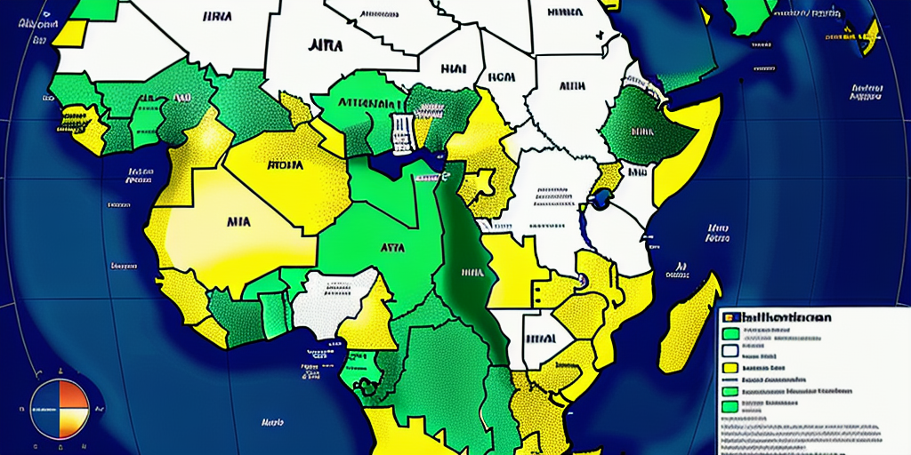
The African Union (AU) has officially endorsed a campaign to replace the traditional world map used in classrooms and official documents with a version that more accurately reflects Africa’s true size. This initiative challenges the long-standing Mercator projection, a map style dating back to the 16th century, which significantly distorts the relative scale of equatorial regions, such as Africa. The shift to a more accurate map is not just about cartographic correctness—it aims to challenge and correct a global narrative so that Africa’s true scale is acknowledged, encouraging better-informed decisions regarding trade, investment, and development. The AU supports the Correct the Map campaign, it signals a growing movement among African nations to assert their presence and correct historical biases entrenched in educational and international perceptions, says the AU. The Equal Earth projection presents a more proportionate view of land masses, but no flat map can perfectly capture the Earth’s spherical nature, writes the AU Commission deputy chairperson Selma Malika Haddadi. The debate touches directly on sustainability and climate action. When Africa is shown at its real scale, the argument goes, its importance in global climate solutions is harder to ignore.
Flawed Mercator Projection
For more than 400 years, the Mercator projection has shaped how people imagine the world. Designed for navigation, it inflates land near the poles and diminishes regions along the equator. The Mercator map distorts the size of continents by enlarging land masses farther from the equator while shrinking those near it. As a result, Africa appears disproportionately small, roughly the same size as Greenland, despite actually being about 14 times larger. This inaccurate depiction perpetuates misconceptions about Africa’s geographical significance and its global standing.
Striving For Equal Earth Projection
In support of a more accurate visual representation, the AU aligns with advocacy groups such as Africa No Filter and Speak Up Africa, who are leading the Correct the Map campaign. Their goal is to encourage institutions like the World Bank and the United Nations to officially adopt the 2018 Equal Earth projection—which better preserves the relative area of continents—thus portraying Africa’s true scale more fairly.
AU Commission deputy chairperson Selma Malika Haddadi described the map as “not just geography but ideology.” In her view, showing Africa as smaller than it is contributes to the perception that the continent is peripheral, a perception that undermines Africa’s claims to resources and representation in international forums. At a time when African leaders are pressing for fairer climate finance and a greater voice in global governance, visibility matters.
The debate touches directly on sustainability and climate action. Africa emits less than 4 percent of global greenhouse gases, yet its communities are among the hardest hit by floods, droughts, and rising temperatures. Advocates argue that a truer picture of Africa’s size highlights its centrality to solving the climate crisis. The continent holds some of the world’s most significant forests, vast potential for solar and wind energy, and a young, growing population driving innovation in adaptation and resilience. When Africa is shown at its real scale, the argument goes, its importance in global climate solutions is harder to ignore.
Confines of Any Flat Map
While the Equal Earth projection presents a more proportionate view of land masses, it’s important to recognize that no flat map can perfectly capture the Earth’s spherical nature. Distortions are inevitable, whether in shape, size, or angles. Nevertheless, the Equal Earth map offers a significant improvement over the Mercator projection in conveying the continents’ true size.
Why Map Accuracy Matters Beyond Borders and Geography
Maps do more than guide travelers—they shape how regions are perceived politically and economically. According to Oxford Analytics, inaccurate depictions like the Mercator map contribute to a misunderstanding of Africa’s potential as a market and economic force. By minimizing Africa’s size, the map implicitly downplays the continent’s vast resources, population, and investment opportunities.
Political analyst Jervin Naidoo emphasizes this point, noting that the distorted image of Africa could lead international investors and policymakers to underestimate the economic prospects of the continent. The shift to a more accurate map is not just about cartographic correctness—it aims to challenge and correct a global narrative so that Africa’s true scale is acknowledged, encouraging better-informed decisions regarding trade, investment, and development.
Wider Impact of Changing the Map
Changing the world map might not yield immediate tangible economic benefits, but the symbolic power of accurately reflecting Africa’s size carries significant weight. An improved visualization can help dismantle outdated stereotypes and foster a greater appreciation of Africa’s contributions and potential on the global stage.
As the AU supports the Correct the Map campaign, it signals a growing movement among African nations to assert their presence and correct historical biases entrenched in educational tools and international perceptions. Recognizing Africa’s true dimensions is a key step in reshaping the continent’s image and influencing future policy and economic engagement.
Redrawing Perspectives for a Fairer Future
The African Union’s endorsement of the campaign to adopt the Equal Earth projection highlights more than just cartographic accuracy—it represents an effort to recalibrate global awareness and respect for Africa’s scale and significance. By advancing a truer view of the continent’s geography, the initiative helps pave the way for increased recognition of Africa’s role as a vast and dynamic player in the world economy.
Moving toward a new world map projection represents not only improved geographic accuracy but a meaningful shift in international attitudes. This change aims to acknowledge Africa’s true dimensions and potential, influencing how countries and corporations engage with the continent. It symbolizes a step toward restoring respect and equality in global discourse, underscoring that how we visualize the world deeply affects economic and political realities.
African Union backs campaign to replace Mercator map that distorts Africa’s size
The African Union has joined a campaign calling for the Mercator map to be replaced. The map makes Africa appear smaller than it is. The Equal Earth map more accurately reflects the continent’s relative size. As of Wednesday evening, the petition was about 800 signatures short of its goal of 5,000. “By correcting the map, we aim to shift perceptions and highlight the true scale, power, and potential of the African continent,” the campaign explained in a slideshow presentation about the effort. “It might seem to be just a map, but in reality, it is not,” AU Commission Deputy Chairperson Selma Malika Haddadi said. “We empower future generations to view Africa not through a lens of distortion or disrespect, but through one of clarity, respect, and African opportunity”
AU Commission Deputy Chairperson Selma Malika Haddadi told Reuters when the size of Africa is misrepresented on maps, the world’s perception of the continent is also distorted, including in media, education and policy.
“It might seem to be just a map, but in reality, it is not,” she said.
Organizations such as Africa No Filter and Speak Up Africa are leading the “Correct The Map” petition. As of Wednesday evening, the petition was about 800 signatures short of its goal of 5,000.
“By correcting the map, we aim to shift perceptions and highlight the true scale, power, and potential of the African continent,” the campaign explained in a slideshow presentation about the effort, which is provided as a resource on its website.
Loading…
Members of the Correct The Map campaign are instead encouraging global entities to adopt the Equal Earth map, which was developed in 2017 by cartographer Tom Patterson and his colleagues.
Patterson’s map projection is what’s known as an equal area map. It shows the true relative sizes of countries and continents, but their shapes are distorted. The Mercator map is conformal, which means shapes are preserved, but actual sizes are distorted.
The Mercator map was developed in 1569 by Gerardus Mercator, a Flemish cartographer. The map allowed explorers to plot their journey in a straight line without having to adjust their compasses.
“That was extremely useful during the age of exploration and European colonialism,” Patterson told NPR. “It almost became the de facto world map.”
On Mercator’s map, Africa appears to be about the same size as Greenland, when in reality, it’s about three times as big, Patterson said.
“That’s just a grotesque distortion, so if you’re using the Mercator map as a world map, say, in the classroom, students would just have a completely warped view of the size of countries in the world,” he said.
Hulton Archive / Getty Images / Getty Images circa 1798: Chart of the world on Mercator’s Projection, with the most recent discoveries.
Patterson said institutions may choose to use the Mercator map so that when users zoom in, a circular object doesn’t become an oval, for example. Groups like NASA and National Geographic have begun using the Equal Earth map, he said. The World Bank told NPR that it’s phasing out the Mercator map in favor of the Equal Earth map, because it’s “committed to ensuring accurate representation of all people, on all platforms.”
Google Maps made the Mercator map optional on its desktop version in 2018, a company spokesperson said.
Organizers of the Correct The Map campaign s say they’ve reached out to the United Nations to assist in its mission to replace the Mercator map. The UN did not respond to NPR’s requests for comment.
“By making this change, we empower future generations to view Africa not through a lens of distortion or disrespect, but through one of clarity, respect, and African opportunity,” the campaign organizers laid out in the slideshow presentation.
Copyright 2025 NPR
African Union Backs Global Calls To Abandon Mercator Map That Reduces Africa’s True Size
The African Union has thrown its weight behind a growing campaign to end the use of the 16th-century Mercator map. The map significantly distorts the scale of continents, inflating regions near the poles such as North America and Greenland while reducing the size of Africa and South America. Campaigners insist that unless the Equal Earth projection becomes the global standard, Africa and other southern continents will continue to be unfairly diminished in the world’s imagination. The campaign is also calling on international organisations such as the UN and the World Bank to replace the Mercator projection. Although Google Maps replaced Mercator with a 3D globe view on its desktop platform in 2018, the mobile application still defaults to the traditional projection.
Originally designed by cartographer Gerardus Mercator for navigation, the map significantly distorts the scale of continents, inflating regions near the poles such as North America and Greenland while reducing the size of Africa and South America.
Speaking to reporters, African Union Commission deputy chair Selma Malika Haddadi said the map created a misleading perception of Africa’s importance. “It might seem to be just a map, but in reality, it is not,” Haddadi stated. She added that the Mercator projection left Africa looking “marginal”, despite being the world’s second-largest continent with over one billion people.
Haddadi argued that such portrayals had long-term consequences, influencing global media, education and policymaking. She confirmed that the AU’s 55 member states would push for alternatives that present Africa more fairly, aligning with its mission of “reclaiming Africa’s rightful place on the global stage” amid mounting calls for reparations for slavery and colonialism.
The renewed debate has been reignited by the Correct the Map campaign, led by advocacy groups Africa No Filter and Speak Up Africa, which champions the Equal Earth projection created in 2018. The projection aims to reflect countries’ true sizes and correct centuries of geographic distortion.
“The current size of the map of Africa is wrong,” said Moky Makura, executive director of Africa No Filter. “It’s the world’s longest misinformation and disinformation campaign, and it just simply has to stop.”
Fara Ndiaye, co-founder of Speak Up Africa, stressed that the Mercator map damages Africans’ identity and pride, especially among children first exposed to it in classrooms.
“We’re actively working on promoting a curriculum where the Equal Earth projection will be the main standard across all [African] classrooms,” Ndiaye explained. She expressed hope that global institutions, including those based in Africa, would adopt it as well.
The campaign is also calling on international organisations such as the UN and the World Bank to replace the Mercator projection. A World Bank spokesperson said the organisation already used the Winkel tripel or Equal Earth projections for static maps and was phasing out Mercator from its web platforms. The group confirmed it had also submitted a formal request to the UN geospatial body, UN-GGIM.
A UN spokesperson noted the proposal would undergo review and require expert committee approval.
Other regions have rallied in support of the AU’s stance. Dorbrene O’Marde, vice-chair of the Caribbean Community Reparations Commission, described the Equal Earth projection as a rejection of what he called the Mercator map’s “ideology of power and dominance.”
Although Google Maps replaced Mercator with a 3D globe view on its desktop platform in 2018, the mobile application still defaults to the traditional projection. Campaigners insist that unless the Equal Earth projection becomes the global standard, Africa and other southern continents will continue to be unfairly diminished in the world’s imagination.
Faridah Abdulkadiri
Follow us on:
PHOTOS: AU backs new map that challenges your perception of Africa
The African Union (AU) has launched a bold initiative to reshape the world’s perception of Africa, beginning with the map. The AU is backing the “Correct The Map” campaign, advocating for the global adoption of the Equal Earth projection. This modern map design aims to replace the centuries-old Mercator projection, which has long misrepresented Africa’s true size and geopolitical significance. By challenging outdated representations, the AU seeks to reclaim Africa’s rightful place on the global stage, countering lingering colonial narratives and fostering a sense of pride and unity among Africans. The campaign aligns with the AU’s broader objectives, particularly its Agenda 2063, which aims to accelerate the political and socio-economic integration of the continent. In classrooms across Africa, students will receive a more accurate understanding of their continent’s size and global position. This shift could influence everything from geography curricula to international trade policies, as a better map fosters a better understanding of Africa’s role in global affairs.
In a move that challenges centuries of distorted geography, the AU is backing the “Correct The Map” campaign, advocating for the global adoption of the Equal Earth projection.
This modern map design aims to replace the centuries-old Mercator projection, which has long misrepresented Africa’s true size and geopolitical significance.
ADVERTISEMENT
Africa covers 30.37 million square kilometres, large enough to fit the United States, China, India, and most of Europe combined.
Equal Earth Projection Map showing the correct size of Africa
A Map That Shrinks Africa
ADVERTISEMENT
Developed in 1569 by Flemish cartographer Gerardus Mercator, the Mercator projection was originally designed for maritime navigation.
However, its cylindrical design distorts landmasses, particularly near the equator. As a result, Africa appears significantly smaller than it is, about 14 times smaller than it should be.
Meanwhile, regions like Greenland and parts of Europe appear disproportionately large.
ADVERTISEMENT
This distortion has perpetuated misconceptions about Africa’s size and importance, influencing global perceptions and policies.
“It might seem to be just a map, but in reality, it is not,” said Selma Malika Haddadi, Deputy Chairperson of the AU Commission.
She argued that the current design has long fostered the false impression that Africa is ‘marginal,’ despite being the world’s second-largest continent by area, with over a billion people.
ADVERTISEMENT
Mercator projection map that shows Africa as a smaller continent
READ ALSO: International celebrities who hold African citizenship
The Equal Earth Alternative
ADVERTISEMENT
The Equal Earth projection, introduced in 2018 by a team of cartographers, offers a more accurate representation of landmasses.
Unlike the Mercator projection, it minimises distortion, providing a more realistic view of the continents’ relative sizes.
The AU, along with advocacy groups like Africa No Filter and Speak Up Africa, is urging educational institutions, governments, and international organisations to adopt this projection.
ADVERTISEMENT
Moky Makura, Executive Director of Africa No Filter, emphasised the significance of this change:”The current size of the map of Africa is wrong. It’s the world’s longest misinformation campaign, and it just simply has to stop.”
Reclaiming Africa’s Global Position
This campaign aligns with the AU’s broader objectives, particularly its Agenda 2063, which aims to accelerate the political and socio-economic integration of the continent.
ADVERTISEMENT
By challenging outdated representations, the AU seeks to reclaim Africa’s rightful place on the global stage, countering lingering colonial narratives and fostering a sense of pride and unity among Africans.
The AU’s endorsement of the “Correct The Map” campaign also reflects a growing movement among other regions.
The Caribbean Community (CARICOM) has similarly supported the Equal Earth projection, viewing it as a rejection of the Mercator map’s “ideology of power and dominance.”
ADVERTISEMENT
AU Commission Deputy Chairperson Selma Malika Haddadi
READ ALSO: 6 African countries with the strongest currencies in 2025
Implications for Education and Policy
ADVERTISEMENT
The adoption of the Equal Earth projection has significant implications for education and policy. In classrooms across Africa, students will receive a more accurate understanding of their continent’s size and global position.
This shift could influence everything from geography curricula to international trade policies, as a more accurate map fosters a better understanding of Africa’s role in global affairs.
Fara Ndiaye, co-founder of Speak Up Africa, highlighted the campaign’s educational impact.
ADVERTISEMENT
“We’re actively working on promoting a curriculum where the Equal Earth projection will be the main standard across all (African) classrooms,” she said.
Fara Ndiaye, co-founder of Speak Up Africa
A Global Call for Change
ADVERTISEMENT
The AU’s call for a new map is not just about cartography; it’s about reshaping perceptions and asserting Africa’s place in the world.
By challenging the dominance of the Mercator projection, the AU is advocating for a more equitable representation of all continents.
This initiative invites global institutions, including the United Nations and the World Bank , to reconsider their mapping standards and adopt projections that reflect the true sizes of all continents.
ADVERTISEMENT
Africa fights back against a distorted 400-year-old world map
The African Union is backing a campaign to replace the 16th-century Mercator map with a more accurate representation of the world. The campaign, aptly named “Correct The Map,” isn’t just about an old piece of paper; it’s about perception, power, and psychology. The distorted map has subtle but real consequences for education, foreign policy, and our national identity. A visually “smaller” Africa can feed into subtle biases in negotiations, policy-making, and media coverage. It is a demand to be seen as we truly are: a key player on a massive, vital continent, writes Nana Karikari, Senior Global Affairs Correspondent for the Ghanaian Embassy in the United Arab Emirates. For more information on the campaign, visit: http://www.africanewspaper.com/correct-the-map-campaign-and-reclaim-our-narrative-for-school-children-in-Ghana.
The African Union has taken a bold step, backing a campaign to replace the 16th-century Mercator map with a more accurate representation of the world. At first glance, this might seem like a simple cartography lesson, but it is a profound move that holds deep meaning for Ghana and the entire continent. The campaign, aptly named “Correct The Map,” isn’t just about an old piece of paper; it’s about perception, power, and psychology. It’s about reclaiming a visual truth that has been denied for centuries.
The Map and the Mind
For centuries, our mental image of the world has been shaped by the Mercator projection. Created by cartographer Gerardus Mercator for navigation, this map has a major flaw: it stretches out the landmasses near the poles. As a result, Greenland, with an area of about 2.1 million square kilometers, appears roughly the same size as Africa, which spans over 30 million square kilometers. To put that in perspective, Africa is so vast it can contain the United States, China, India, Japan, and most of Europe all at once. This visual distortion, where continents near the equator look far smaller than their true size, has a powerful psychological effect.
The problem isn’t that Mercator was malicious; he simply needed a flat map where a ship could follow a straight line and get to its destination. The real issue is that this navigational tool became the standard classroom map. As AU Commission deputy chairperson Selma Malika Haddadi told Reuters, the Mercator map fosters a “false impression” that Africa is “marginal” and small. “It might seem to be just a map,” she said, “but in reality, it is not.”
Correcting the Narrative
For ordinary Ghanaians, this campaign might feel far removed from daily life. But the effects of this visual misrepresentation are not. The distorted map has subtle but real consequences for education, foreign policy, and our national identity.
Our school books and classrooms have long used the Mercator map, teaching generations of Ghanaian students a distorted view of their continent’s scale and importance. This is a human issue. It affects our pride and our confidence. Imagine being a child taught from your earliest years that your home is small and insignificant compared to others. As Professor De-Valera N.Y.M. Botchway of the University of Cape Coast puts it, whatever is taught in the classroom must “free them from the bonds of colonial mentality and neo-colonialism.” Replacing this map with a more accurate one, like the Equal Earth projection, is a powerful act of decolonization in the classroom. It’s
about giving our children a more truthful foundation for understanding their identity and their position in a global context. This isn’t just a symbolic change; it’s an educational one.
In the world of global power dynamics, perception is a form of power. A visually “smaller” Africa can feed into subtle biases in negotiations, policy-making, and media coverage. When world leaders or journalists subconsciously see Africa as marginal, it can affect how they treat its nations and its people. This campaign is a way for the African Union to assert Africa’s true size—and by extension, its true political and economic weight. Moky Makura, executive director of Africa No Filter, calls the Mercator map “the world’s longest misinformation and disinformation campaign, and it just simply has to stop.”
For Ghana, a leader in West Africa and a nation with a proud history of championing pan-Africanism under founding father Kwame Nkrumah, this campaign is about reclaiming our narrative. It is a demand to be seen as we truly are: a key player on a massive, vital continent. It’s about reminding ourselves and the world that our land is vast, our population is growing, and our influence is undeniable. As Gabby Asare Otchere-Darko, a prominent Ghanaian statesman and founder of the Africa Prosperity Network, wrote, “The 1569 Mercator map did not merely misrepresent Africa’s size—it mutilated its dignity and incapacitated its destiny.”
This is a struggle we know well. While the Mercator map was being used to shrink Africa, a pioneering Ghanaian cartographer, George Ekem Ferguson, was meticulously surveying and mapping the borders of the Gold Coast (now Ghana) in the late 19th century. His work laid the foundations for our modern state, and his legacy is a testament to our ability to define ourselves against external forces.
A Call for Balance and Action
Of course, not everyone agrees on the urgency of this issue. Critics might argue that replacing a map is a symbolic gesture that distracts from more pressing problems like governance, economic instability, or corruption. They might say, “It’s just a map; our real problems are more serious.”
But the two ideas are not mutually exclusive. The map is a symbol of a deeper issue. Changing it is a visible, public statement that says, “We see ourselves, and we demand that the world see us, as we are.” For Ghana, the “Correct The Map” campaign is an opportunity. It’s a chance to champion a change that goes beyond our borders. It’s an opportunity for our educators to bring a new, more accurate tool into the classroom. It’s an opportunity for our leaders to leverage this momentum to talk about our continent’s size, population, and influence in a new light. This is not a trivial debate. It is a strategic move to correct a historical bias and empower a new generation of Africans who understand that their home is not just a place on a map, but a central force on the world stage.
This is a fight for our narrative, our identity, and our collective destiny. Correcting the map is the first step in a long, but essential, journey toward correcting history itself.
Read More Here