IMD forecasts more rain in September, warns hill states
How did your country report this? Share your view in the comments.
Diverging Reports Breakdown
IMD forecasts more rain in September, warns hill states
The India Meteorological Department (IMD) forecast above-normal September rainfall, with precipitation projected to exceed the 109% of the long-term average. This will come after the northwest region that includes the Capital and swathes of the sensitive mountain ranges, recording their wettest August since 2001. The warning comes as large-scale devastation continues across Jammu and Kashmir, Himachal Pradesh, Uttarakhand and Punjab, where incessant rainfall has triggered landslides, flash floods, road cave-ins and extensive infrastructure collapse. The weather office warned of extensive heavy rainfall over the next two weeks across north India, central India and Indo-Gangetic plains. The normal monsoon withdrawal date from Rajasthan has shifted from September 1 to September 17, indicating extended rainfall activity. Since June 1, India has received 743.1 millimetres of rainfall — 6.1% above the long term average of 700.7 millimetre. However, regional distribution varies significantly: northwest India recorded a 26.7% surplus while east and northeast regions faced a 17.8% deficiency.
In its monthly weather preview, the IMD forecast above-normal September rainfall, with precipitation projected to exceed the 109% of the long-term average extending over the next two months. This will come after the northwest region that includes the Capital and swathes of the sensitive mountain ranges, recording their wettest August since 2001.
“We are anticipating good, above-normal rainfall during the month. This can lead to episodic occurrence of cloudbursts, mudslides, landslides,” warned M Mohapatra, the weather department’s director general. “Authorities should be prepared.”
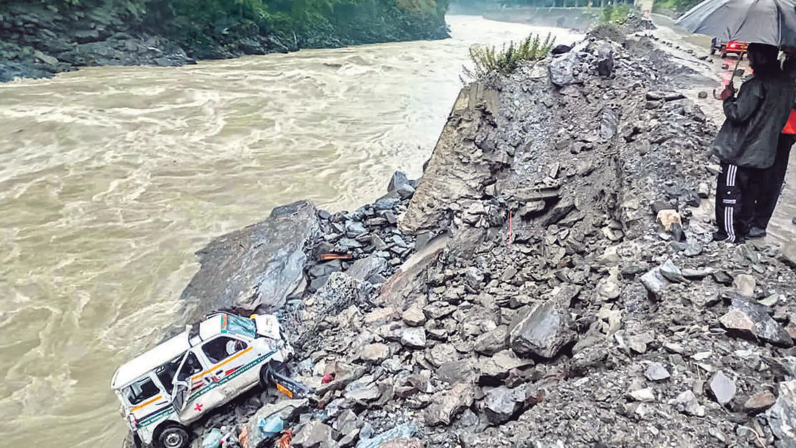
The warning comes as large-scale devastation continues across Jammu and Kashmir, Himachal Pradesh, Uttarakhand and Punjab, where incessant rainfall has triggered landslides, flash floods, road cave-ins and extensive infrastructure collapse.
Recent disasters include the Dharali village flood in Uttarakhand, and cloudbursts and flooding in Jammu and Kashmir and Himachal Pradesh. Most of India will likely receive normal to above-normal rainfall in September, except northeastern and eastern regions, southern peninsular areas, and northernmost districts, where below-normal precipitation is expected.
The monthly average, based on 1971-2020 data, is 167.9 millimetres.
August brought exceptional weather extremes, with northwest India recording 265 millimetres — the highest since 2001 and 13th highest since 1901, the weather office stated as it released data for the month. The southern peninsula logged its third-highest August rainfall since 2001.
Several meteorological stations recorded extraordinary downpours: Raigad measured 440 millimetres and ghat areas of Madhya Maharashtra recorded 570 millimetres on August 20, while Jammu’s Udhampur district saw 630 millimetres on August 27.
Precipitating this mayhem were interactions of multiple systems. Five active weather disturbances intensified rain over Himalayan states and northwestern plains during August, creating what Mohapatra described as “active to vigorous monsoon conditions”. Three such interactions in August directly contributed to the deadly incidents across the region.
Since June 1, India has received 743.1 millimetres of rainfall — 6.1% above the long-term average of 700.7 millimetres. However, regional distribution varies significantly: northwest India recorded a 26.7% surplus while east and northeast regions faced a 17.8% deficiency. Central India saw an 8.6% surplus and southern India recorded 9.3% excess.
Mohapatra highlighted a new trend: September rainfall has increased since 1980, with sharper rises in the past five years. The normal monsoon withdrawal date from Rajasthan has shifted from September 1 to September 17, indicating extended rainfall activity.
“September is a transitional month. One factor may be the interaction of western disturbances with monsoon during this month,” he said.
Temperature forecasts show day readings remaining normal to below-normal across west-central, northwest and southern regions, but above-normal in east-central, eastern and northeastern states and along parts of the west coast. Night temperatures will likely stay normal to above-normal across most areas, dipping below average only in parts of the northwest and southern peninsula.
Downstream flooding risks
The weather office warned of extensive heavy rainfall over the next two weeks across north India, central India and Indo-Gangetic plains. Mohapatra emphasised particular concern for downstream areas: “Many rivers originate in Uttarakhand. So, heavy rainfall means many rivers will be flooded and it will impact cities and towns downstream.”
The department acknowledged that while above-normal rainfall significantly benefits agriculture and water resources, it brings heightened risks of flooding, landslides, transport disruptions, public health challenges and ecosystem damage.
“To manage these risks effectively, it is essential to reinforce infrastructure, utilise IMD’s early warnings, enhance surveillance and conservation efforts, and establish robust response systems in vulnerable sectors,” the department said.
Climate patterns support continued activity
Currently, neutral El Niño-Southern Oscillation conditions prevail over the equatorial Pacific — an important factor for stable monsoon performance. Climate models, including the Monsoon Mission Climate Forecast System, suggest these neutral conditions will persist through the season, with possible temporary La Niña development in October-December.
Over the Indian Ocean, neutral Indian Ocean Dipole conditions are observed, though models predict a weak negative phase towards monsoon’s end.
El Niño phases typically suppress monsoon activity, while La Niña generally supports stronger rainfall by strengthening pressure gradients that drive monsoon circulation. The current neutral phase provides a relatively balanced environment, allowing regional weather systems to operate without large-scale interference from Pacific temperature anomalies.
In May, the weather department predicted the monsoon season would record between 102% and 106% of average rainfall — a projection the country is tracking despite significant regional variations.