
Major Winter Storm Set to Impact Nevada-California Region
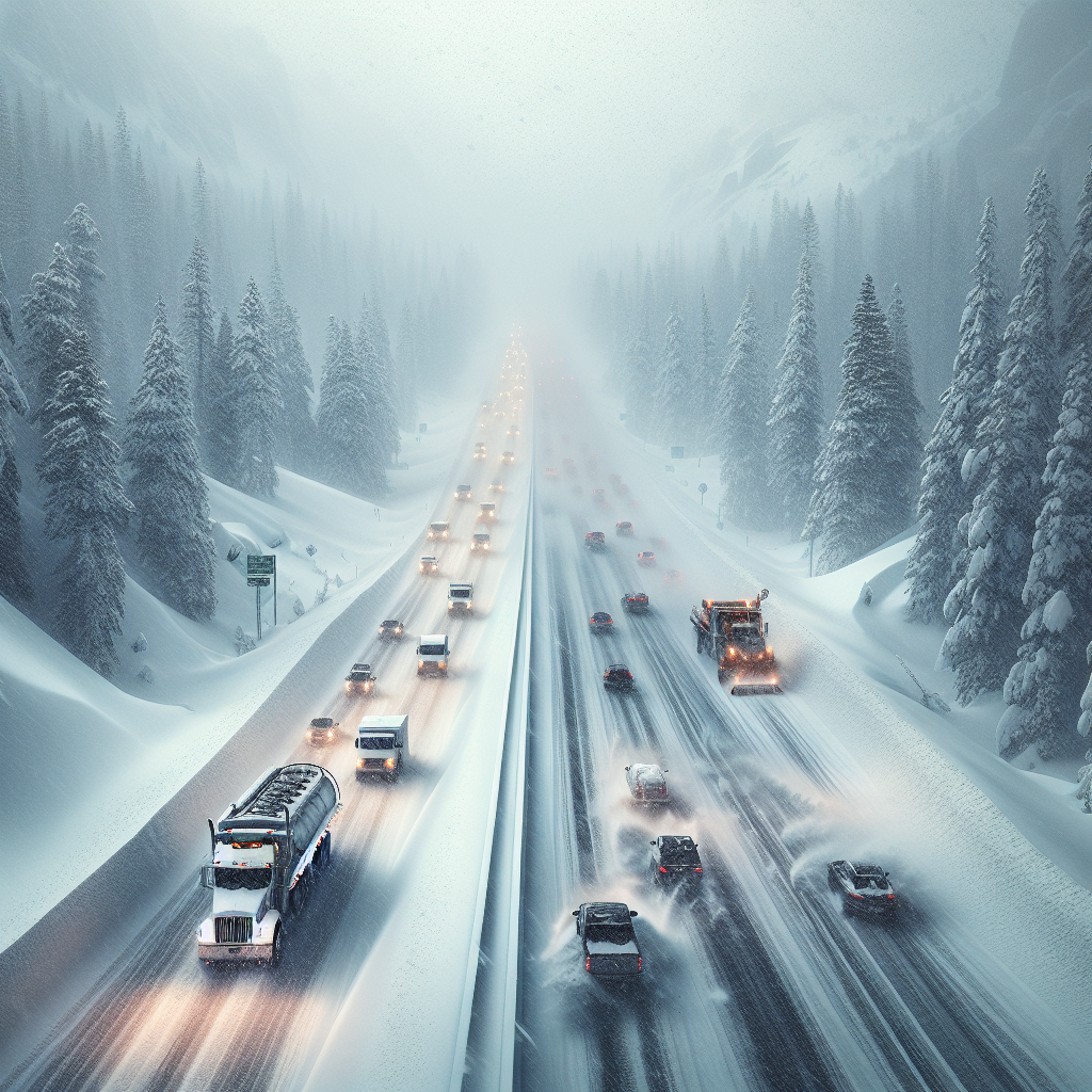
Weather Alert: Difficult to Impossible Travel on I-80
A substantial winter storm is heading towards the Sierra late Wednesday, bringing with it several feet of snow anticipated to disrupt travel along the Interstate 80 and other crucial mountain passes. According to the National Weather Service in Reno, snowfall totaling up to 5 feet could blanket Donner Pass by Friday night. This prediction has created considerable concern for travelers planning to navigate through this region.
Tahoe’s Weather Forecast for the Week
- Wednesday: Although the day will start with sunny skies, snow is anticipated to commence by nightfall, with 1 to 3 inches expected at lake level and 1 to 4 inches in areas above 7,000 feet.
- Thursday: Forecasts indicate snow accumulation of 3 to 9 inches for elevations above 6,400 feet, and heavy snowfall ranging from 15 to 23 inches above 7,000 feet. The winds could gust up to 40 mph.
- Friday: Snow is expected throughout the day, potentially accompanied by wind gusts up to 35 mph. Even though the weekend will bring periodic snow, no additional significant accumulation is expected.
Reno-Sparks Weather and Conditions
The Reno-Sparks area will see limited snow compared to the higher elevations:
- Wednesday Night: Expect less than half an inch of snow on the valley floor.
- Thursday: Light snow may turn to rain in the morning, with another layer of less than an inch of snow accumulation possible before it transitions.
- Friday: Morning rain and snow showers are anticipated, followed by clearer conditions towards the evening, though with a potential slight chance of rain the following Sunday.
Interstate 80 Conditions Through Donner Pass
For those planning trips through the western Sierra, particularly Donner Pass, the conditions are expected to be severe:
- Storm Warning: Starting from 10 p.m. Wednesday through 10 p.m. Friday, heavy snowfall between 2 and 5 feet is expected above 6,000 feet.
- Forecast for Mid-Elevations: Areas between 4,500 and 6,000 feet could see snowfall ranging from 5 to 15 inches, paired with intense wind gusts potentially reaching 60 mph.
- Travel Advisory: Prepare for chain controls and possible road closures; conditions are likely to be hazardous, with snow occurrence rates of 1 to 2 inches per hour on Thursday.
Essential Weather Resources
To ensure safe travel and informed decisions during this snowstorm event, various resources can be consulted:
- National Weather Service: Updated forecasts and weather alerts are available at weather.gov.
- Nevada Department of Transportation: Visit nvroads.com or dot.nv.gov for current road conditions and access to traffic cameras.
- Caltrans: For California road updates, check roads.dot.ca.gov.
- NV Energy Weather Stations: Obtain real-time weather data from various locations at nvenergy.westernweathergroup.com.
- ALERTWildfire: Access live camera footage of current conditions at alertwildfire.org.
Prepare for Unpredictable Winter Weather
This week presents challenging weather conditions, particularly for travel across the Sierra and along Interstate 80. As always, proceeding with caution and staying informed through local weather resources is critical. Ensure vehicles are winter-ready, have emergency kits onboard, and consider altering travel plans if necessary to avoid the brunt of the storm.
Source: https://www.rgj.com/story/weather/2025/02/12/winter-storm-to-cripple-california-nevada-travel-with-5-feet-of-snow/78436690007/