Conditions favourable for monsoon to advance over Delhi, Haryana, Punjab: IMD
How did your country report this? Share your view in the comments.
Diverging Reports Breakdown
Conditions favourable for monsoon to advance over Delhi, Haryana, Punjab: IMD
The monsoon is the lifeblood of India’s economy. It arrived in Kerala on May 24, eight days before its normal date. Parts of Punjab, Haryana, and Delhi are yet to receive the first spells of monsoon rain. Heavy to very heavy rainfall and extremely heavy rain were recorded in sub-Himalayan West Bengal, Sikkim, Gujarat and Konkan. The monsoon advances northwards, usually in surges, and covers the entire country around July 15. It marks the transition from scorching temperatures to the dry season. The northern limit of the monsoon was passing through Barmer, Jodhpur, Jaipur (Rajasthan), Agra, Rampur, Bijnor (Uttar Pradesh), Karnal (Haryana)
The monsoon is the lifeblood of India’s economy. It arrived in Kerala on May 24, eight days before its normal date. June 1 is the normal date for monsoon onset in Kerala.
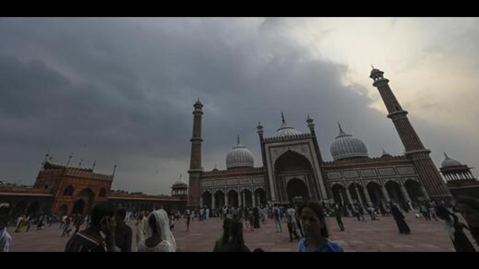
The IMD said conditions were favourable for the monsoon advance to more parts of Rajasthan, Punjab, Haryana, Delhi, and the remaining areas of western Uttar Pradesh over the next 36 hours.
The northern limit of the monsoon was passing through Barmer, Jodhpur, Jaipur (Rajasthan), Agra, Rampur, Bijnor (Uttar Pradesh), Karnal (Haryana), and Punjab’s Halwara.
Heavy to very heavy rainfall and extremely heavy rain were recorded in sub-Himalayan West Bengal, Sikkim, Gujarat and Konkan, east Rajasthan, Uttarakhand, Punjab, Haryana, Uttar Pradesh, Madhya Pradesh, Madhya Maharashtra, Arunachal Pradesh, Assam, and Meghalaya. Heavy rainfall was recorded at isolated places in Odisha, Karnataka, and Manipur.
The monsoon advances northwards, usually in surges, and covers the entire country around July 15. It marks the transition from scorching temperatures. According to the agriculture ministry, 51% of India’s farmed area, accounting for 40% of production, is rain-fed, making monsoon critical. With 47% of the country’s population dependent on agriculture for their livelihood, a bountiful monsoon is directly related to a healthy rural economy.
The IMD said isolated heavy rainfall was likely in Punjab, Haryana, Himachal Pradesh, Uttarakhand, West Uttar Pradesh, Rajasthan, Jammu and Kashmir, Ladakh, Gilgit, Baltistan, and Muzaffarabad, east Uttar Pradesh, until June 30
On Sunday, IMD director general M Mohapatra said the monsoon has covered most of north India a bit early, but they were yet to give the forecast for the entire country. “Key states of Punjab, Haryana, Delhi, and parts of Rajasthan are also left to be covered. We expect these states will be covered over the next few days.”
He said good rainfall was expected this week, especially because of a low-pressure area over south Uttar Pradesh and Gangetic West Bengal. “These features are good for the monsoon.”
Monsoon covered most of North; may reach Punjab, Haryana, Delhi in 2 days: IMD
Monsoon has covered most of north India by Sunday. Conditions favourable for its further advancement in parts of North Arabian Sea. The northern limit of monsoon is now passing through Jaipur, Agra, Rampur, Dehradun, Shimla, Pathankot and Jammu.Normally, by June 15, monsoon advances over more parts of Maharashtra including Mumbai, Telangana, south Chhattisgarh, remaining areas of central India, most areas of Odisha, most parts of West Bengal, Sikkim and some eastern areas of Bihar and Jharkhand. It then advances over southern parts of Gujarat and Kutch, south Madhya Pradesh, remaining parts of Odishas, and most parts. of north Chhatt isgarh by June 20. It advances over the remaining areas. of northwest India by July 8. Monsoon made its onset over Kerala eight days in advance on May 24 and covered large parts of the country.
Until Sunday, monsoon advanced over most parts of Himachal Pradesh and Jammu, entire Ladakh and Kashmir, and some parts of Punjab, leaving out northwestern states Haryana and Delhi. The northern limit of monsoon is now passing through Jaipur, Agra, Rampur, Dehradun, Shimla, Pathankot and Jammu.
Also Read | Heavy rain to hit Delhi tomorrow, IMD issues yellow alert
“Monsoon has covered most of north India a bit early, but we have not yet given the forecast for the coverage of the entire country. Key states of Punjab, Haryana and Delhi and parts of Rajasthan are also left to be covered,” IMD director general M Mohapatra said. “We are expecting that these states will be covered over the next few days. We are expecting good rainfall over the next few days especially because of a low pressure area over south Uttar Pradesh, and over Gangetic West Bengal. These features are good for the monsoon.”
Normally, by June 15, monsoon advances over more parts of Maharashtra including Mumbai, remaining areas of Telangana, south Chhattisgarh, remaining areas of central India, most areas of Odisha, most parts of West Bengal, Sikkim and some eastern areas of Bihar and Jharkhand. It then advances over southern parts of Gujarat and Kutch, remaining parts of Maharashtra, south Madhya Pradesh, remaining parts of Odisha, and most parts of north Chhattisgarh, most areas of Jharkhand and Bihar by June 20.
Also Read | Monsoon advances further, heavy rainfall alert in Himachal
Thereafter, monsoon progresses further north and westwards and covers most parts of Gujarat and Kutch, Madhya Pradesh, Uttar Pradesh, Uttarakhand, Ladakh, Jammu and Kashmir, Punjab and Haryana, Delhi and east Rajasthan by June 30. It advances over the remaining areas of northwest India by July 8.
This year, the monsoon has covered most areas earlier than expected and has had an unusual trajectory so far. Monsoon made its onset over Kerala eight days in advance on May 24 and covered large parts of the country, including Mumbai on the west coast, soon after. But, it did not progress at all between May 29 and June 15. After June 15, there has been a surge and monsoon caught up with its early trajectory.
Maximum temperatures were markedly above normal (> 5.1°C) at few places over Jammu-Kashmir-Ladakh-Gilgit-Baltistan-Muzaffarabad and at isolated places over Odisha; and appreciably above normal (3.1°C to 5.0°C) at isolated places over Assam and Meghalaya, sub Himalayan West Bengal and Sikkim, Himachal Pradesh, Chhattisgarh, coastal Andhra Pradesh, Yanam, Tamil Nadu, Puducherry, Karaikal and Kerala and Mahe.
A low-pressure area is over southeast Uttar Pradesh and its neighbourhood, and the associated upper air cyclonic circulation in middle tropospheric levels is tilting southwards with height. It is likely to move slowly northwestwards and weaken gradually over the next 12 hours.
An east-west shear line/trough runs from south Pakistan to central parts of Bangladesh across central parts of Rajasthan, northwest Madhya Pradesh, cyclonic circulation associated with low pressure area over central parts of south Uttar Pradesh and neighbourhood, Jharkhand, north Gangetic West Bengal in lower tropospheric levels.
A trough from north Punjab to north Bihar across south Haryana, and the cyclonic circulation associated with low pressure area is over central parts of south Uttar Pradesh in lower tropospheric levels. An upper air cyclonic circulation is lying over northeast Assam in lower tropospheric levels, and another is also likely to form over Gangetic West Bengal and its neighbourhood around June 25.
Read more news like this on HindustanTimes.com