Massive dust cloud from Sahara Desert travels toward U.S.
How did your country report this? Share your view in the comments.
Diverging Reports Breakdown
Saharan dust heads for Florida: What to expect
Saharan dust travels to the Sunshine State each summer, causing hazy skies, colorful sunsets, and lower air quality. The dry, dusty air can weaken or block hurricane formation. The dust isn’t all bad. It’s full of minerals, like iron, that can fertilize the ocean, especially around places like the Florida Keys. However, the dust may also carry bacteria, fungi, and viruses from Africa. Some scientists think these tiny travelers could affect both people and plants, but research is still ongoing. The Saharan Air Layer is both friend and foe, and yet another example of the wonder of weather and the interconnectedness of the continents. It can actually stop hurricanes from forming or weaken ones that already exist. Since warm water fuels hurricanes, cooler water means weaker storms.
Saharan dust is heading toward Florida! Here’s what that means for us.
What is Saharan Dust?
What we know:
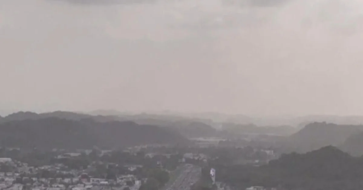
Every summer, strong winds blow massive clouds of dust off the Sahara Desert in Africa. This is called the Saharan Air Layer, or SAL. These dust clouds ride the wind across the Atlantic Ocean, sometimes traveling more than 5,000 miles all the way to Florida.
Local perspective:
When the dust arrives, it can:
Create hazy skies and reduce visibility
Produce beautiful orange and pink sunrises/sunsets
Lower air quality (especially tough for people with asthma or breathing issues)
Good and Bad Effects
The dust isn’t all bad. It’s full of minerals, like iron, that can fertilize the ocean, especially around places like the Florida Keys. These minerals feed coral reefs and ocean plants, keeping ecosystems healthy. However, the dust may also carry bacteria, fungi, and viruses from Africa. Some scientists think these tiny travelers could affect both people and plants, but research is still ongoing.
MORE NEWS | Tracking The Tropics: FOX 35 2025 Hurricane Season Preview
How does it travel so far?
Dig deeper:
Powerful winds over the Sahara lift the dust high into the atmosphere—up to 15,000 feet or more! Then, strong trade winds carry it westward across the Atlantic like a sky-high highway. That’s how it ends up in the Caribbean and the southeastern U.S., including Florida.
Why does the dust die down later in the summer?
Timeline:
By August and September, Saharan dust storms usually slow down.
More Rain: As the Atlantic Ocean gets warmer, it creates more humid air and tropical rain. These rains help wash the dust out of the sky.
Weaker Wind Systems: The pressure systems that help lift and move dust from Africa weaken later in the season.
Changing Atmosphere: The air becomes more tropical—warm and wet, which is not friendly for dry, dusty SAL air.
The Dust vs. Hurricanes
Here’s something really important: The Saharan Air Layer can actually stop hurricanes from forming or weaken ones that already exist.
How?
Dry Air: Tropical storms need warm, moist air to grow. The SAL is very dry, and when it mixes with a developing storm, it dries out the storm’s fuel source.
Strong Winds: The SAL often travels with strong upper-level winds. These can create wind shear, which is like cutting the top off a storm. That makes it harder for the storm to stay organized and grow stronger.
Dust Particles: All the tiny particles in the air can also reflect sunlight, which cools the ocean surface slightly. Since warm water fuels hurricanes, cooler water means weaker storms.
So while the dust might make the skies hazy, it also acts like a natural hurricane blocker—at least temporarily.
WATCH: Giant manta ray dives under Florida paddleboarder
Big picture view:
Saharan air is a sign that summer is near, and every year its dusty clouds move through the Caribbean, into Florida and up through the Gulf Coast. The SAL is both friend and foe, and yet another example of the wonder of weather and the interconnectedness of the continents.
STAY CONNECTED WITH FOX 35 ORLANDO:
Massive Dust Cloud From The Sahara Blowing Across The Ocean Toward The US
A massive cloud of dust from the Sahara Desert is currently enveloping the Caribbean and is projected to move towards the United States. This natural phenomenon, known as the Saharan Air Layer, occurs annually and can have significant impacts on air quality and weather patterns. The National Weather Service advises individuals, especially those with respiratory conditions, to stay indoors
The dust cloud typically forms when strong winds lift dust particles from the Sahara Desert into the atmosphere. These particles then travel across the Atlantic Ocean, reaching the Caribbean and sometimes extending as far as the United States. While the dust can create stunning sunsets, it can also reduce air quality and exacerbate respiratory issues for those with pre-existing conditions.
Meteorologists are closely monitoring the movement of the dust cloud as it approaches the U.S. The National Weather Service advises individuals, especially those with respiratory conditions, to stay indoors and limit outdoor activities when the dust is present.
As the dust cloud progresses, it is expected to affect parts of the southern United States, including Texas and Florida. Residents in these areas should prepare for potential impacts on air quality and visibility.
Huge Sahara dust cloud smothers the Caribbean en route to the U.S.
A massive cloud of dust from the Sahara Desert blanketed most of the Caribbean on Monday. The cloud extended some 3,200 kilometres from Jamaica to well past Barbados in the eastern Caribbean. The dust concentration was high, at 0.55 aerosol optical depth — the highest amount so far this year. The hazy skies unleashed sneezes, coughs and watery eyes across the Caribbean, with local forecasters warning that those with allergies, asthma and other conditions should remain indoors or wear face masks if outdoors. This plume is expected to hit Florida, Louisiana, Alabama and Mississippi late this week and into the weekend.
The cloud extended some 3,200 kilometres from Jamaica to well past Barbados in the eastern Caribbean, and some 1,200 kilometres from the Turks and Caicos Islands in the northern Caribbean down south to Trinidad and Tobago.
“It’s very impressive,” said Alex DaSilva, lead hurricane expert with AccuWeather.
The hazy skies unleashed sneezes, coughs and watery eyes across the Caribbean, with local forecasters warning that those with allergies, asthma and other conditions should remain indoors or wear face masks if outdoors.
The dust concentration was high, at 0.55 aerosol optical depth — the highest amount so far this year, said Yidiana Zayas, a forecaster with the U.S. National Weather Service in San Juan, Puerto Rico.
The aerosol optical depth measures how much direct sunlight is prevented from reaching the ground by particles, according to the U.S. National Oceanic and Atmospheric Administration.
WATCH | When Sahara sand, dust blew into U.K. in 2014: Sahara sand, dust blows into U.K. Duration 1:59 Gale force winds carried particles more than 3,000 kilometres north
This plume is expected to hit Florida, Louisiana, Alabama and Mississippi late this week and into the weekend, DaSilva said. However, plumes usually lose most of their concentration in the eastern Caribbean, he noted.
“Those islands tend to see more of an impact, more of a concentration where it can actually block out the sun a little bit at times,” he said.
The dry and dusty air known as the Saharan Air Layer forms over the Sahara Desert in Africa and moves west across the Atlantic Ocean starting around April until about October, according to NOAA. It also prevents tropical waves from forming during the Atlantic hurricane season, which runs June 1 to Nov. 30.
People enjoy the beach as a cloud of dust from the Sahara Desert blankets the Caribbean Sea, in Carolina, Puerto Rico, on Monday. (Ricardo Arduengo/Reuters)
June and July usually have the highest dust concentration on average, with plumes traveling anywhere from 1,500 metres (5,000 feet) to 6,100 metres (20,000 feet) above the ground, DaSilva said.
In June 2020, a record-breaking cloud of Sahara dust smothered the Caribbean. The size and concentration of the plume hadn’t been seen in half a century, prompting forecasters to nickname it the “Godzilla dust cloud.”
Florida braces for ‘dirty rain’ as massive cloud of Saharan dust rolls in
The enormous plume was formed by strong winds sweeping tiny sand and mineral particles off the surface of the Sahara – and the current wave is the largest of the season. Thunderstorms are forecasted for the Sunshine State on Saturday and Sunday that will combine with the dust particles and leave a film on everything the droplets touch. While the tainted precipitation and plume are mostly harmless, experts have urged people with respiratory issues to wear face coverings outside. The Sahara dust forms over the African desert every spring, extending one to three miles above the surface and reaching thousands of miles in length. Data showed it was between 60 to 70 percent dustier than average, making it the dustiest event since records began around 20 years ago. The dust is a major source of nutrients for marine plants that drift on or near the ocean’s surface, triggering blooms of phytoplankton to form on the surface. It is also essential for life in the Amazon forest, which would otherwise be depleted by frequent rainfall.
Thunderstorms are forecasted for the Sunshine State on Saturday and Sunday that will combine with the dust particles and leave a film on everything the droplets touch.
While the tainted precipitation and plume are mostly harmless, experts have urged people with respiratory issues to wear face coverings outside.
The enormous plume was formed by strong winds sweeping tiny sand and mineral particles off the surface of the Sahara – and the current wave is the largest of the season.
Meteorologists have warned Florida to prepare for ‘dirty rain’ as a plume of Saharan dust is set to engulf the state this weekend
FOX Weather Meteorologist Britta Merwin said: ‘You have this creepy layer of gross stuff on your car; you’re like, it’s not pollen, it’s dust.
‘Look out for the dust collecting. Also, if it lands on your (air conditioner), it can clog it up, so (it’s a) good idea to spray off your units.’
Every summer the wind carries large amounts of desert dust particles from the hot and dry desert in northern Africa westerly across the Atlantic.
Large amounts of dust particles from the African desert are swept up into the dry air by thunderstorms and strong winds near the ground.
The dust can then float for days, or weeks, depending on how dry, fast and turbulent the air masses become
The plume of Saharan dust traveled more than 4,000 miles from Africa over the last month or so, passing over central Florida by Wednesday.
However, the dust is expected to linger into the weekend when thunderstorms are predicted to roll in.
And the combination of the rain and dust will create ‘splotches of mud left on surfaces,’ according to FOX Weather.
The Saharan dust hit the eastern coast of Florida earlier this month, which enhanced sunrises and sunsets by scattering more light in the sky.
While the dust plume may annoy Americans, it is a good sign amid hurricane season.
The National Hurricane Center reported active tropical waves are coming off the African coast, but the dust particles absorb sunlight and act as an air stabilizer to reduce tropical waves so cyclones can’t develop.
Every summer the wind carries large amounts of desert dust particles from the hot and dry desert in northern Africa westerly across the Atlantic
Thunderstorms are forecasted for the Sunshine State on Saturday and Sunday that will combine with the dust particles and leave a film on everything the droplets touch
This year is projected to be one of the most active on record, with 24 named storms predicted to occur, 11 of which are expected to escalate into hurricanes.
The Sahara dust forms over the African desert every spring, extending one to three miles above the surface and reaching thousands of miles in length.
Outbreaks usually occur every three to five days until they peak in mid-June through mid-August, often bringing colorful and hazy sunsets to the Florida coast characterized by their yellow and red hues.
As the dust travels toward the US, a dry pocket of air forms thousands of feet above sea level, it will bring drier air and hotter conditions, suppressing tropical developments like hurricanes by removing the moisture they need to form.
They also form strong winds in the upper areas of the dust plume, which can reach up to 60 miles an hour and rip cloud tops off any tropical hurricanes.
The plume in 2020 was the largest on record, earning the name ‘Godzilla.’ Data showed it was between 60 to 70 percent dustier than average, making it the dustiest event since records began around 20 years ago
The plume in 2020 was the largest on record, earning the name ‘Godzilla.’
Data showed it was between 60 to 70 percent dustier than average, making it the dustiest event since records began around 20 years ago.
Although the small particles can trigger air quality alerts and irritate those with respiratory issues, the dust can also enhance sunsets, suppress tropical storm development and play an important role in our ecosystem.
The dust is a major source of nutrients for phytoplankton – microscopic marine plants that drift on or near the ocean’s surface/
Some of the minerals from the dust fall into the ocean, triggering blooms of phytoplankton to form on the ocean surface, which in turn provides food for other marine life.
The dust is also essential for life in the Amazon as it replenishes nutrients in rainforest soils, which would otherwise be depleted by frequent rainfall.
Saharan Dust Map Shows Huge Plume Approaching Texas
The state of Texas is bracing for a Saharan dust outbreak, as large plumes travel northward from the African desert and move over the Atlantic. The plume is the largest of the 2024 hurricane season and it will stall tropical development from Africa to the Caribbean. The natural phenomenon essentially steals moisture from the air as sand, dirt and other dust from the Sahara desert area travel through the Earth’s atmosphere. The warmth, dryness and strong winds that come with the dust clouds have been shown to suppress tropical cyclone formation and intensification. The best times of day to spot it are usually after sunrise and in the late afternoon. A heavy amount of dust traveling through the atmosphere enhances this scientific effect, leading to duskier colors.
Newsweek AI is in beta. Translations may contain inaccuracies—please refer to the original content.
The state of Texas is bracing for a Saharan dust outbreak, as large plumes travel northward from the African desert and move over the Atlantic.
The Saharan Air Layer (SAL) is the dust that forms over the Sahara during the summer. It comprises sand and mineral particles swept up from 3.5 million square miles of the African desert. Saharan dust reduces visibility in regions and negatively impacts air quality, creating poor conditions.
Read more: Learn More About Emergency Funds and Where to Keep Them
The dust is set to gust into the Atlantic, which will suppress the development of storms. The plume is the largest of the 2024 hurricane season and it will stall tropical development from Africa to the Caribbean.
“The Saharan Air Layer is a mass of very dry, dusty air that forms over the Sahara Desert during the late spring, summer, and early fall and moves over the tropical North Atlantic every three to five days,” according to the National Weather Service.
Read more: What Is a Health Savings Account?
The natural phenomenon essentially steals moisture from the air as sand, dirt and other dust from the Sahara desert area travel through the Earth’s atmosphere.
These plumes are common in the Atlantic around late June and early July, according to the National Oceanic and Atmospheric Administration.
Dust covers a residential area during a dust storm in Lubbock, Texas. The state is bracing for a Saharan dust outbreak. Dust covers a residential area during a dust storm in Lubbock, Texas. The state is bracing for a Saharan dust outbreak. Zach Long/Lubbock Avalanche-Journal
Saharan dust clouds can impact locations thousands of miles away from their origins in Africa. The dust outbreaks tend to occupy a 2 to 2.5-mile-thick layer of the atmosphere with the base starting about 1 mile above the surface.
Read more: How to Build an Emergency Fund
The warmth, dryness and strong winds that come with the dust clouds have been shown to suppress tropical cyclone formation and intensification.
The best times of day to spot it are usually after sunrise and in the late afternoon. A heavy amount of dust traveling through the atmosphere enhances this scientific effect, leading to duskier colors. Due to the unique way in which Saharan dust scatters sunlight, the sky will have a hazy white look and sunsets will take on an orange glow.
Clouds with dust from the African Sahara colored the sunset on March 30, 2024. Texas is bracing for a Saharan dust outbreak. Clouds with dust from the African Sahara colored the sunset on March 30, 2024. Texas is bracing for a Saharan dust outbreak. Lubos Pavlicek/CTK
Dust in the atmosphere can create magnificent and vivid sunsets that enhance the skyline, leading to sunsets and sunrises taking on more yellow and reddish hues due to the low-angle sunlight that passes through the atmosphere before it can be seen by the human eye.
Do you have a story we should be covering? Do you have any questions about this article? Contact LiveNews@newsweek.com
Source: https://www.cbsnews.com/video/massive-dust-cloud-from-sahara-desert-travels-towards-us/