What has caused an ‘early’ monsoon onset in India this year?
How did your country report this? Share your view in the comments.
Diverging Reports Breakdown
What has caused an ‘early’ monsoon onset in India this year?
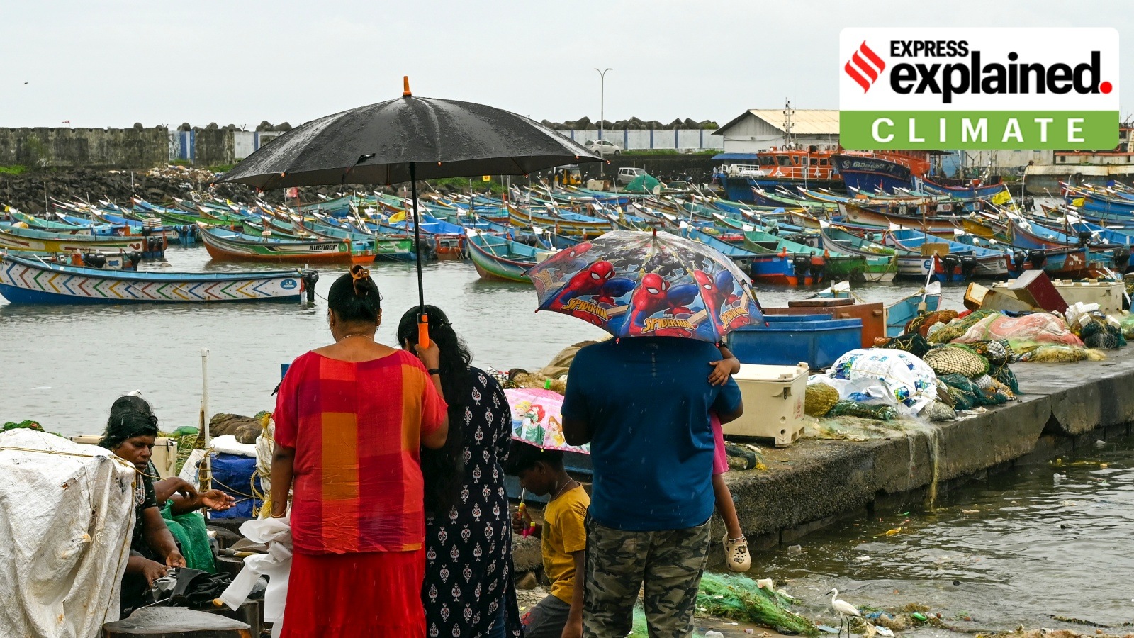
The India Meteorological Department (IMD) declared the monsoon onset over Kerala on Saturday (May 24), eight days ahead of its normal date schedule of June 1. The onset marks the beginning of the four-month, June-September southwest monsoon season over India, which brings more than 70 per cent of the country’s annual rainfall. This year, there has been a simultaneous onset over the entire Lakshadweep, Mahe (Puducherry), many parts of the Arabian Sea and the Bay of Bengal. The monsoon arrived over the south Andaman Sea and neighbourhood areas on May 13, against a normal of May 21. The IMD termed the onset to have taken place under ‘very’ favourable conditions, including: The Madden-Julian Oscillation (MJO): It is one of the most important and complex ocean-atmospheric phenomena influencing Indian monsoons, with origins in the Indian Ocean. It is a disturbance of clouds, wind and pressure that moves eastward at a speed of 4-8 metres per second.
It last happened in 2009 that the monsoon arrived so early in the year, on May 23. Here is how the onset is declared, and what impacted it this year.
When is the onset of monsoon declared?
The IMD attempts to declare the schedule for southwest monsoon onset any time after May 10. To do so, certain essential criteria are considered, including:
Story continues below this ad
1. Rainfall: If 60% of the available 14 southern meteorological stations – Minicoy, Amini, Thiruvananthapuram, Punalur, Kollam, Allapuzha, Kottayam, Kochi, Thrissur, Kozhikode, Thalassery, Kannur, Kudulu and Mangalore – report rainfall measuring 2.5 mm or more rainfall for two consecutive days.
2. Wind field: Westerly winds blow from West to East in the 30 to 60 degree latitudes, both in the northern and southern hemispheres. For the onset, the depth of westerly winds should be maintained at upto 600 hectoPascals or hPa, which is the unit for measuring atmospheric pressure, and wind speeds must range between 15-20 knots (27-37km/hr) at 925 hPa.
3. Outgoing Longwave Radiation (OLR): The Earth both absorbs and reflects energy from the Sun, and the difference between these processes impacts the Earth’s temperature and atmosphere. For instance, larger aerosol particles in the atmosphere interact with and absorb some of the radiation, thus warming the atmosphere. According to NASA, the resultant heat is emitted as longwave infrared radiation.
OLR includes radiation from the warmed upper atmosphere, along with a small amount from the Earth’s surface. Most of OLR warms the lower atmosphere, in turn warming the surface. For India’s southwest monsoon, Satellite-derived OLR values should be below 200 Watts per square metre.
Story continues below this ad
If all these criteria are fulfilled, the IMD declares the monsoon onset over Kerala on the second day of observations. This year, there has been a simultaneous onset over the entire Lakshadweep, Mahe (Puducherry), many parts of the Arabian Sea and the Bay of Bengal, along with monsoon winds reaching parts of southern Karnataka and Mizoram in northeast India.
What factors contributed to the early onset?
Multiple, large-scale atmosphere-oceanic and local factors developed and favoured the early monsoon onset this year. The monsoon arrived over the south Andaman Sea and neighbourhood areas on May 13, against a normal of May 21.
The IMD termed the onset to have taken place under ‘very’ favourable conditions, including:
1. The Madden-Julian Oscillation (MJO): It is one of the most important and complex ocean-atmospheric phenomena influencing Indian monsoons, with origins in the Indian Ocean. A key feature is that a disturbance of clouds, wind and pressure moves eastward at a speed of 4-8 metres per second. Within 30 to 60 days, MJO wind bands can travel around the world and cause significant weather changes during their movement. In a favourable phase, it can enhance rainfall over India during the monsoon season.
Story continues below this ad
2. Mascarene High: The IMD describes the Mascarene High as a high-pressure area found around the Mascarene Islands (in the south Indian Ocean) during the monsoon period. The variation in the intensity of high pressure is responsible for heavy rains along India’s west coast.
Monsoon advance, as of the afternoon of May 25. (IMD) Monsoon advance, as of the afternoon of May 25. (IMD)
3. Convection: An increase in the convective activity, that is, the vertical transport of heat and moisture in the atmosphere, also brings rainfall. For example, a convective system over Haryana moved southeastward last week and led to rains in the Delhi region.
4. The Somali jet: It is a low-level, inter-hemispheric cross-equatorial wind band originating near Mauritius and north Madagascar. During May, after crossing the east coast of Africa, it reaches the Arabian Sea and the west coast of India. A strong Somali jet is associated with the strengthening of monsoon winds.
5. Heat-low: Following the movement of the Sun to the northern hemisphere, marking the summer season, a low-pressure area develops in the Arabian Sea. The development of a heat-low pressure zone over Pakistan and adjoining areas acted as a suction device for moist air along the monsoon trough, and its strong presence influences good monsoon rainfall.
Story continues below this ad
6. Monsoon trough: It is an elongated low-pressure area extending from the heat low to the north Bay of Bengal. The north-south swinging of this trough causes rainfall during the June–September period across the core monsoon zone.
Pressure gradient and monsoon onset vortex, a cyclonic formation in the Arabian Sea, also play a role in heralding a good monsoon.
A comparison of the normal v/s realised onset dates over select locations
Location Normal date Realised date 2025 Port Blair May 21 May 15 – 16 Thiruvananthapuram June 1 May 24 Kochi June 1 May 24 Bangalore June 3 May 24 Shimoga June 4 May 24 Karwar June 5 May 24
Source: IMD
Which regions did the monsoon cover on its onset day?
The southwest monsoon has hit India with a bang, covering the southwest and east-central Bay of Bengal, Maldives and Comorin regions, south and central Arabian Sea, Kerala, Lakshadweep and Mahe.
Story continues below this ad
It has made a simultaneous and early onset over northeast India (Mizoram), southern and coastal Karnataka and Tamil Nadu (except its northern regions).
Under normal conditions, the monsoon crosses central Kerala and reaches Karnataka around June 5, making this year’s onset the earliest over these regions in recent years. In Karnataka, the onset advance is over 10 days this year.
On Sunday, the second day since the onset, the southwest monsoon further advanced into some parts of west-central and east-central Arabian Sea, more parts of Karnataka, the entirety of Goa, some parts of Maharashtra, parts of west-central and north Bay of Bengal, and of Mizoram, Manipur and Nagaland.
The Northern Limit of Monsoon, an imaginary line marking the progress of the southwest monsoon, now passes through Devgad, Belagavi, Haveri, Mandya, Dharmapuri, Chennai, Aizawl and Kohima.
Monsoon Arrived Early. Above-Normal Rainfall Expected in Delhi, UP, and Bihar This Season
The India Meteorological Department (IMD) has confirmed the early arrival of the southwest monsoon in Kerala. This unexpected advancement has brought pre-monsoon showers across several parts of the country, setting the stage for a season of rainfall that may outperform the long-term average. Forecast models attribute this accelerated pace to favorable conditions over the Arabian Sea and the Bay of Bengal, where early cyclonic activity and wind convergence have catalyzed moisture movement inland. The reduction in western disturbance activity over the Himalayas has cleared the path for smoother and earlier monsoon penetration across the Indo-Gangetic plains. In Uttarakhand, districts like Pithoragarh and Mukteshwar reported significant rainfall figures of 78.2 mm and 59 mm respectively within a 24-hour period.
Experts from the IMD have predicted above-normal rainfall this year in key northern states such as Uttar Pradesh, Bihar, Jharkhand, and West Bengal. These projections have raised optimism among farmers, urban planners, and environmentalists alike, given the increasing water stress and climatic unpredictability in recent years.
Delhi Could Receive Monsoon Showers Before June 27 as Per Forecast Models; Shift in Wind Patterns and Oceanic Activity Behind the Early Surge
As per current estimates, Delhi is likely to welcome monsoon showers before June 27, deviating from its usual schedule. Forecast models attribute this accelerated pace to favorable conditions over the Arabian Sea and the Bay of Bengal, where early cyclonic activity and wind convergence have catalyzed moisture movement inland.
Meteorologists also point out that the reduction in western disturbance activity over the Himalayas has cleared the path for smoother and earlier monsoon penetration across the Indo-Gangetic plains.
Not Just the South—Northern States Begin Receiving Pre-Monsoon Rains: Vehicles Stranded, Trees Uprooted, Urban Drainage Under Pressure
The early rains have not come without consequences. In parts of Uttar Pradesh and Bihar, intense showers over the weekend caused localized waterlogging, falling trees, and disruption in vehicular traffic. Similar scenes were witnessed in some urban centers, where municipal infrastructure struggled to cope with the sudden downpour.
In Uttarakhand, districts like Pithoragarh and Mukteshwar reported significant rainfall figures of 78.2 mm and 59 mm respectively within a 24-hour period, signaling a strong start to the monsoon season in hilly terrain.
Climate Anomalies and Ocean Temperatures Play a Critical Role in Monsoon Acceleration; Experts Link Phenomenon to Long-Term Climatic Shifts
Meteorological experts have listed multiple reasons for this early arrival:
Accelerated oceanic conditions in both the Arabian Sea and Bay of Bengal.
Reduced resistance from western weather systems .
Rapid formation of low-pressure systems and cyclonic circulations .
Broader patterns of climate variability and warming seas, potentially tied to long-term climate change.
How This Year’s Onset Compares with Previous Ones: 2024 Marks an Unusually Early Start After a Delay in 2023
Year Date of Monsoon Arrival in Kerala 2024 30 May 2023 08 June 2022 29 May 2021 03 June 2020 01 June
This year’s 30th May arrival mirrors some of the earliest entries in recent memory. Notably, in 2009, the monsoon hit Kerala on 23 May, one of the earliest arrivals on record. The 1990 monsoon season was also notable, with the system entering 13 days ahead of the expected schedule.
Bihar Among Key States to Benefit from Early Monsoon; Government Urges Farmers to Begin Preparations for Timely Kharif Sowing
In agricultural states like Bihar, where over 70% of the population depends on rain-fed farming, the early onset of monsoon is being viewed as a blessing. The local administration is reportedly gearing up to facilitate early sowing of Kharif crops such as paddy, maize, and pulses.
The IMD has further indicated the possibility of continued heavy rains across parts of Bihar, Jharkhand, West Bengal, and Odisha over the coming days.
Mumbai likely to get early monsoon this year, say experts
Mumbai is witnessing an unusually early spell of pre-monsoon showers this May. With the city’s average May rainfall typically just 12 mm, such widespread rain this early in the month caught many by surprise. The India Meteorological Department (IMD) indicated that the southwest monsoon is expected to hit Kerala around May 27, with a model error of four days. A few independent forecasters believe this could mean an early onset in Mumbai as well—possibly around the first few days of the month instead of the usual June 11 date.
With the city’s average May rainfall typically just 12 mm, such widespread rain this early in the month caught many by surprise.
Tired of too many ads? go ad free now
“It’s unusual for Mumbai to see pre-monsoon activities from early May like what we saw on May 7-8 this year.
With the monthly average being just 12 mm, usually, the city only sees stray showers towards the end of May, which is also not a guarantee every year,” said independent forecaster Athreya Shetty.
Shetty also points out how the current pre-monsoon activity already pushed rainfall totals close to 50 mm — levels not seen since the early 2000s, if one discounts the exceptional 2021 year spell brought on by Cyclone Tauktae, which was 230 mm.
Rainfall recorded this year since March 1 by the IMD Colaba and Santacruz conservatory was 62.8 mm and 38.4 mm, of which a majority was recorded this month itself.
This current surge in pre-monsoon showers also raised hopes of an early monsoon arrival. The India Meteorological Department (IMD) indicated that the southwest monsoon is expected to hit Kerala around May 27, with a model error of four days. A few independent forecasters believe this could mean an early onset in Mumbai as well—possibly around the first few days of the month instead of the usual June 11 date.
Rushikesh Agre, who tracks Mumbai weather and regularly posts on it from his social media handle on X and Instagram, said that monsoon onset over Mumbai is likely around June 5–7, 2025. “Based on current indicators, its progression is expected to accelerate over the next 4–5 days, with strong activity expected over the following two weeks,” he said.
Rajesh Kapadia, who runs the private weather blog Vagaries of the Weather, also agreed that this year’s pre-monsoon activity arrived earlier than usual. “Heat isn’t making headlines this peak summer. Instead, there’s ample moisture and frequent thunderstorm buildup—conditions that point to a likely early onset of the monsoon in Mumbai,” Kapadia said.
The IMD, meanwhile, placed Mumbai under a light to moderate rainfall warning until June 20, 2025, suggesting the city could continue to see frequent showers in the days leading up to the monsoon’s formal arrival.
Chennai On Alert After Monsoon Arrives Early in Kerala: IMD Flags Strong Winds, Sea Caution
The southwest monsoon has officially arrived in Kerala on 24 May, marking an eight-day early onset compared to its usual date of 1 June. This year’s early onset is one of the earliest in recent history, with the last such early arrival occurring in 2009, when the monsoon hit on 23 May. The development has prompted the India Meteorological Department (IMD) to issue multiple weather and sea advisories, especially for coastal regions like Chennai and surrounding areas in Tamil Nadu. Weather authorities have issued alerts for port areas in response to strong winds caused by the early onset.
Chennai: The southwest : The southwest monsoon has officially arrived in Kerala on 24 May, marking an eight-day early onset compared to its usual date of 1 June. This year’s early onset is one of the earliest in recent history, with the last such early arrival occurring in 2009, when the monsoon hit on 23 May. The development has prompted the India Meteorological Department (IMD) to issue multiple weather and sea advisories, especially for coastal regions like Chennai and surrounding areas in Tamil Nadu.
“This is much earlier than the normal onset,” said an IMD official. “If you see the past 16 years’ data, in 2009, the monsoon set in on 23 May. This year, it is 8 days earlier.”
Chennai Coast Under Caution While Chennai awaits the monsoon’s advancement over the next few days, weather authorities have issued alerts for port areas in response to strong winds caused by the early onset. The IMD has hoisted Distant Cautionary Signal Number 1 for Chennai, Puducherry, and Karaikal ports. Meanwhile, Local Cautionary Signal Number 3 has been raised for Tuticorin and Pamban, indicating moderate sea conditions and advising vessels to exercise caution.
The IMD warned that wind speeds between 35-45 kmph, gusting up to 55 kmph, are expected to persist along the Tamil Nadu coast from 24–28 May. This includes south Tamil Nadu’s coastal zones, Gulf of Mannar, and Comorin coast. Similar conditions are forecasted for the Bay of Bengal, particularly along the Andhra coast, central Bay regions, and Andaman Sea.
“Fishermen are advised not to venture into the Arabian Sea during 24th to 28th May,” the IMD stated.
Monsoon Onset Not an Indicator of Northeast Season Meteorologists have also clarified that while the monsoon has set in early over Kerala, it does not determine the performance of the northeast monsoon, which is crucial for Tamil Nadu, especially Chennai.
“At present, we will not be able to say how the performance of northeast monsoon will be based on the fact that southwest monsoon has set in today over Kerala. Let us monitor the progress and then we will issue the long-range forecast,” the official added.
Warnings have also been issued for the Western Ghats regions in Nilgiris, Coimbatore, and Tirunelveli, with emphasis on fisherman safety and strong sea conditions.
(with inputs from ANI)
Earliest Monsoon in 16 Years Hits Kerala: Heavy Rains, Storm Warnings Across Southern India
The India Meteorological Department (IMD) confirms that all favorable atmospheric conditions have aligned for the onset of monsoon in the next 24 hours. This year’s early entry marks a significant shift, potentially landing on May 25, surpassing the last early arrivals seen in 2009 and 2001. The IMD forecasts continued heavy to very heavy rainfall across Kerala and coastal Karnataka through May 29. A depression over the east-central Arabian Sea, situated around 40 km northwest of Ratnagiri, is expected to cross the Konkan coast. This system is accelerating monsoon conditions in Maharashtra and Goa, enhancing rainfall potential in these coastal belts. A red alert has been issued for coastal Maharashtra, particularly Mumbai, which is likely to face thunderstorms and moderate rains.
Thiruvananthapuram – : Kerala is poised to welcome the earliest monsoon arrival in 16 years, with the India Meteorological Department (IMD) confirming that all favorable atmospheric conditions have aligned for the onset of monsoon in the next 24 hours. Typically expected by June 1, this year’s early entry marks a significant shift, potentially landing on May 25, surpassing the last early arrivals seen in 2009 and 2001.
Heavy Rainfall Pounds Kerala as Monsoon Advances
Several parts of Kerala have already experienced torrential rains in the last two days, signaling the advancing monsoon system combined with a low-pressure area. The early monsoon surge has also brought strong winds between 40-50 kmph, amplifying rainfall intensity. The IMD forecasts continued heavy to very heavy rainfall across Kerala and coastal Karnataka through May 29, marking a wet and turbulent start to the season.
Depression in Arabian Sea Intensifies Monsoon Activity
A depression over the east-central Arabian Sea, situated around 40 km northwest of Ratnagiri, is expected to cross the Konkan coast between Ratnagiri and Dapoli. This system is accelerating monsoon conditions in Maharashtra and Goa, enhancing rainfall potential in these coastal belts.
South India Weather Update: Thunderstorms, Winds, and Showers
Karnataka : Coastal and south interior regions are under alert for heavy rainfall , especially around Mangaluru and Udupi.
: Coastal and south interior regions are under alert for , especially around Mangaluru and Udupi. Tamil Nadu, Andhra Pradesh & Telangana: These states are set to receive scattered rain showers and thunderstorms over the next five days.
Regional Forecasts and Alerts Across India
Maharashtra
A red alert has been issued for coastal Maharashtra, particularly Mumbai, which is likely to face thunderstorms and moderate rains. The IMD anticipates wind speeds of 40–50 kmph, potentially disrupting normal life in low-lying urban zones.
Goa
Goa is bracing for intense rainfall. With a red alert in effect, the IMD warns of very heavy downpours till Sunday, following consistent showers over the last 24 hours.
Delhi-NCR
Residents of Delhi-NCR should prepare for gusty winds reaching up to 70 kmph, with an orange alert in place for potential disruptions, especially during peak commuting hours.
Jharkhand
The state is forecast to receive thunderstorms and gusty winds in the coming days. Temperatures are likely to remain below seasonal averages, between 31°C and 37°C, offering a brief respite from the usual late-May heat.
Monsoon Timeline and Historical Reference
The IMD projects that this year’s monsoon, expected to begin on May 25 in Kerala, will gradually cover the entire nation by July 8. The monsoon typically starts retreating by September 17 and fully withdraws by October 15. For reference:
Earliest Monsoon Onset : May 11 (1918)
: May 11 (1918) Most Delayed Onset : June 18 (1972)
: June 18 (1972) Most Delayed in Recent 25 Years: June 9 (2016)
Above-Normal Rainfall Forecast for 2025
In April, the IMD forecasted above-normal monsoon rainfall for the year 2025, ruling out El Nino conditions, which are typically associated with below-average rains in India. This prediction raises hopes for strong agricultural output and replenishment of water resources across the country.